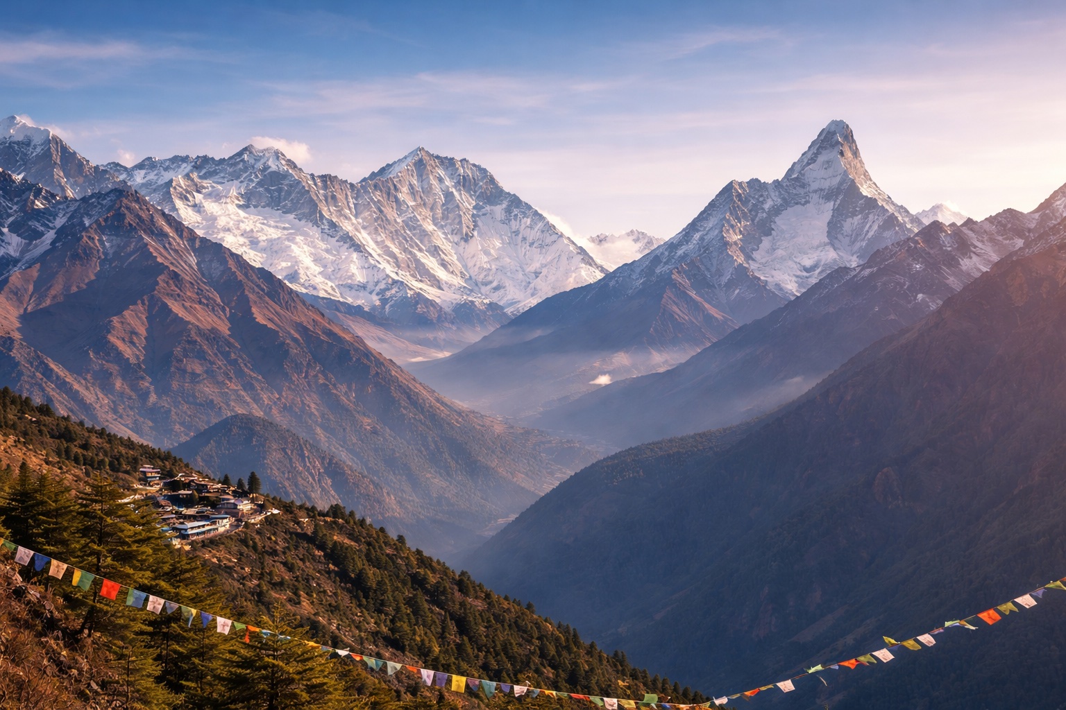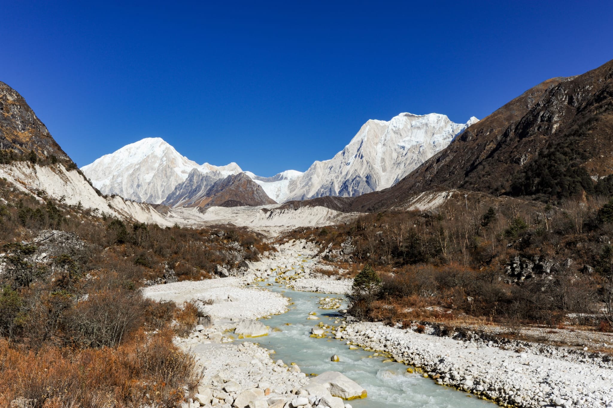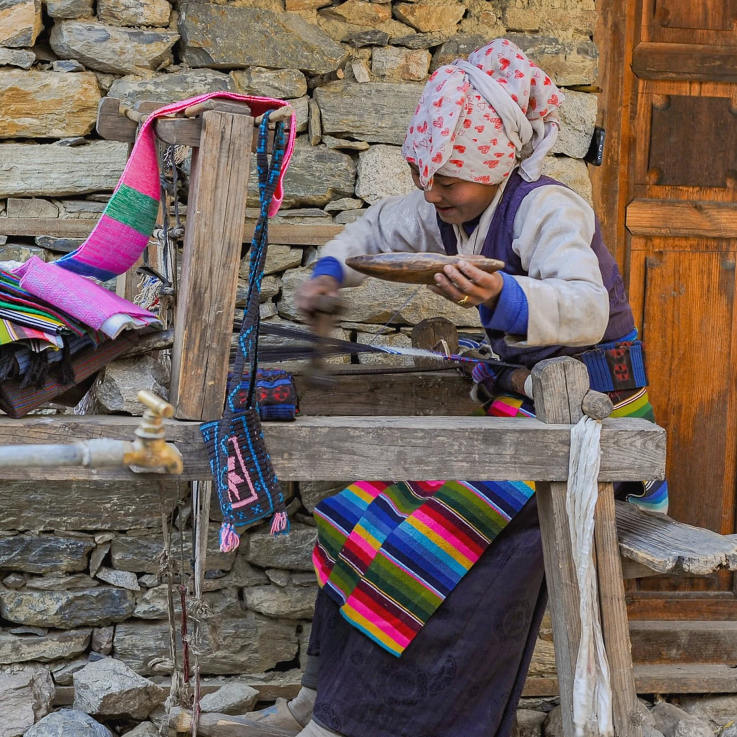
The Manaslu Round and Tsum Valley Treks offer one of Nepal’s most rewarding Himalayan experiences. The Mount Manaslu (8,163 m), whose name comes from the Sanskrit Manasa, meaning “mountain of the spirit” or “mountain of the soul.” This remote region blends dramatic mountain scenery with traditional village life and Tibetan Buddhist culture, featuring deep valleys, terraced fields, forests and glacial landscapes. The trek begins in the lower Budhi Gandaki Valley, following the river through villages inhabited by Gurung, Sherpa and Tibetan-influenced communities, where monasteries, mani walls, chortens and prayer flags shape daily life. From Saula Gaon, the valley narrows, wildlife may be seen, and the trail passes Pungen Gumba, a sacred cave where Guru Rinpoche is said to have meditated. From Samdo, the Tibetan border adds a sense of remoteness. The trek then crosses Larkya La Pass (5,135 m) before descending through glacial valleys, yak pastures and remote villages.
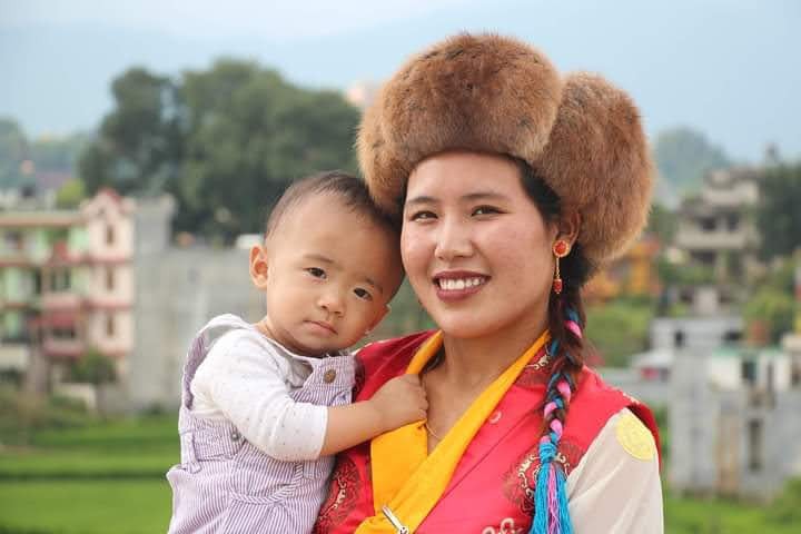
The Tsum Valley, in northern Manaslu near the Tibetan border, adds a culturally rich extension. Opened to trekking only in 2007, it remains sacred and well-preserved, inhabited mainly by the Tsumbas, an ethnic group of Tibetan origin. Life centres on farming, yak herding and monastic traditions, with mani walls, chortens and monasteries shaping daily life. Tsum is regarded as a beyul, a hidden sacred land blessed by Guru Rinpoche, linked to the yogi Milarepa. Over six days, the trail passes fertile fields and remote villages beneath 7,000‑metre peaks, reaching Mu Monastery, the last village before the Tibetan border. Trekkers return the same way via Lokpa and Barpak before driving back to Kathmandu, completing a journey combining natural beauty, culture and spiritual insight without attempting the full Manaslu Circuit.
Arrival in Kathmandu (1,350 m). Transfer to hotel.
Your memorable holiday begins in Kathmandu. After arrival, you will have time to freshen up before meeting your guide for an afternoon briefing. This is the perfect moment to organize your trekking gear and prepare your bags for the journey ahead.
Accommodation: Hotel. Meals included: morning
Transport : 20 M drive hotel
Kathmandu - Machha Khola (900 m)
Today, we drive from Kathmandu to Machhakhola (900 m) by jeep. We first follow the highway to Muglin, then head toward Arughat. After that, the road becomes rough and passes through villages like Soti Khola, following the Budi Gandaki River. The drive is scenic with hills, rivers and fields, ending at Machhakhola, the starting point of the Manaslu trek.
Machha Khola - Jagat (1,340 m)
After breakfast, we hike to Jagat following the Budi Gandaki River, crossing suspension bridges and passing small villages. The trail gently climbs through forests and farmland. After about 5-6 hours, you reach Jagat, a stone-paved village and the entry point to the Manaslu Conservation Area. The route offers nice river views and local village life. .
Accommodation: Lodge. Meals included: morning noon evening.
Elevation gain: 1100 m. Elevation loss: 700 m. 7 hours walking.
Jagat - Lokpa (2,240 m)
The day begins with a gentle uphill walk along the Budi Gandaki River, passing through forests and small villages. After crossing the river, the trail continues to climb gradually until reaching Philim, a large Gurung village renowned for its stone houses and terraced fields. From Philim, the path leads on to Lokpa, winding past local farms and quiet, peaceful landscapes. The walk remains calm and scenic throughout, with beautiful views of the surrounding hills and traditional villages.
Accommodation: Lodge. Meals included: morning noon evening.
Elevation gain :1150 m Elevation loss: 250 m. 5/6 hours walking.
Lokpa - Chumling (2970 m)
The walk from Lokpa to Chumling is fairly easy. It begins with a gentle uphill climb through forests and terraced fields, with calm landscapes and lovely views of the surrounding hills and valleys. The trail also includes some downhill sections, which add variety to the walk. Chumling is a quiet and picturesque village, offering a real sense of local life and culture. The route is gentle enough for walking in hilly terrain and provides a peaceful, scenic experience.
Accommodation: Lodge. Meals included: morning noon evening.
Elevation gain :250 m Elevation loss: 90 m. 3/4 hours walking
Chumling - Chhokangparo (3,010 m)
The day begins with a steady journey deeper into the Tsum Valley. From Chumling, the trail descends gently and crosses a long suspension bridge over the Shiar Khola. The path then climbs gradually through pine and rhododendron forests, passing mani walls and chortens that reflect the region’s Buddhist heritage. Small villages and fields of barley and buckwheat appear along the way, with the landscape opening up higher on the ascent. Spectacular views of Ganesh Himal and other snow-capped peaks unfold before reaching Chhokangparo, a twin village perched on a broad plateau, offering sweeping mountain vistas and a glimpse into a remote, spiritual community.
Accommodation: Lodge. Meals included: morning noon evening.
Elevation gain :850 m Elevation loss: 200 m. 4/5 hours walking
Chhokangparo - Chule-Nile (3,361 m)
From Chhokangparo, the trail follows the Shiar Khola, passing mani walls and small villages. The first stop is Chule, a traditional village with stone houses. A short uphill walk then leads to Nile (3,361?m), the last village before the Tibetan border, known for its peaceful setting and stunning mountain views.
Accommodation: Lodge. Meals included: morning noon evening.
Elevation gain :390 m Elevation loss: 50 m. 5/6 hours walking.
Nile - Mu Gompa (3,700 m) - Lamagoun (3,300 m)
Today, the trail gently ascends along the Shiar Khola, passing mani walls and yak pastures, with amazing views of Ganesh Himal. After hours, you reach Mu Gompa (3,700 m), the highest and most spiritual monastery in Tsum Valley. After exploring the monastery and its surroundings, you retrace your steps downhill and continue past Nile to reach Lamagoun for an overnight stay. The route blends scenic beauty with deep cultural experience.
Accommodation: Lodge. Meals included: morning noon evening.
Elevation gain :350 m Elevation loss: 520 m. 5/6 hours walking
Lamagoun - Ripchet (2,470 m)
Today is mostly downhill, passing through alpine meadows and forests. The trail follows the Shiar Khola, crosses a suspension bridge, and winds through pine and rhododendron woods. It is peaceful, lined with prayer flags and chortens. After a few hours, Ripchet is reached, a quiet village with traditional homes and farmland, offering a glimpse of the simple life in the Tsum Valley.
Accommodation: Lodge. Meals included: morning noon evening.
Elevation gain :120 m Elevation loss: 750 m. 4/5 hours walking
Rupchet - Dyang (1,800 m)
After breakfast, the trail is retraced in the morning to the junction of the Manaslu Circuit. The path crosses a suspension bridge and continues along the trail winding above the Budi Gandaki River. The route includes several ups and downs. As the elevation is lost, the air becomes warmer and the vegetation more lush. After several hours, Dyang is reached, a small village nestled in a narrow valley, surrounded by cliffs and forests. It offers a peaceful stop with views of waterfalls and the surrounding hills.
Accommodation: Lodge. Meals included: morning noon evening.
Elevation gain :500 m Elevation loss: 135 m. 5/7 hours walking.
Dyang - Bhi Phedi (1990 m) - Namrung (2,680 m)
After a short walk, the river is crossed and the trail begins to climb gently through forests and small villages. A suspension bridge is crossed along the way. From Bihi Phedi, the path becomes steeper as the ascent continues towards Namrung. The route passes traditional villages, mani walls, chortens and stupas, with pleasant views of the surrounding mountains. The steady climb is rewarding and ends at Namrung.
Accommodation: Lodge. Meals included: morning noon evening.
Elevation gain: 1340 m. Elevation loss: 480 m. 6/5 hours walking.
Namrung - Syaula (3,490 m)
Today offers a good chance of seeing monkeys along the trail. A short but steep climb leads to Lihi village, where fine views can be enjoyed, including Lamjung Himal. After passing Shyo village, the scenery opens up with clear views of Mt Manaslu and traditional Tibetan-style houses that show the local culture. The walk then reaches Lho village, which is known for the largest monastery in the area, standing above the village with impressive mountain views. As the trail continues higher, the trees become fewer and the landscape more open. After a few hours of walking, Syaula is reached, a peaceful village ideal for rest and altitude adjustment.
Accommodation: Lodge. Meals included: morning noon evening.
Elevation gain: 1120 m. Elevation loss: 240 m. 6 / 7 hours walking.
Syaula - Pugyen Gumba - Sama Gaon (3530 m)
Early in the morning, even before breakfast, there are majestic views of the surrounding mountains. The day begins with the warmth of the sun, climbing through forests and yak pastures towards the Pungen Glacier and the peaceful Pungyen Gumba. This quiet monastery offers close and impressive views of Mt Manaslu. After visiting the Gumba, the path retraces and then descends to Samagaon, the largest village in the area. The village is known for its mani walls, traditional houses and rich Tibetan culture, all set among magnificent mountain scenery.
Accommodation: Lodge. Meals included: morning noon evening.
Elevation gain: 880 m. Elevation loss: 610 m. 5 / 6 hours walking.
Samagaon - Lake Birendra (3,691 m) - Samdo (3,680 m )
Today is a short day with an easy walk to Birendra Lake, a beautiful lake offering fine views of Mt Manaslu. The path then returns to the main trail and continues to Samdo. Although the village seems small, it has a lively local population and is the last village in the region that is lived in throughout the year.
Accommodation: Lodge. Meals included: morning noon evening.
Elevation gain: 460 m. Elevation loss: 160 m. 3 to 4 hours walking.
Samdo - Dharmasala (Larkya High Camp) (4,460 m)
After breakfast, the walk begins slowly towards Dharamsala. Along the way, there are clear views of the valley near the Tibetan border, where local people traditionally travelled for trade. In the past, Tibetan traders used to come with their yaks to sell goods in this area. After crossing the river, the trail climbs steadily to Dharamsala. A calm and steady pace helps the body adjust to the higher altitude
Accommodation: Lodge. Meals included: morning noon evening.
Elevation gain: 520 m. 4 hours walking.
Dharmasala - Larkya La (5,106 m) - Bhimthang (3,650 m)
Today begins with a gentle ascent along the eastern side of the pass, which at first feels very slow but allows time to enjoy the surroundings. As the climb progresses, the trail opens up to impressive views of Kang Guru (6,981?m), then Cheo Himal (6,820?m), and Himlung Himal (7,126?m). Near the top, the striking Larkya Peak (6,222?m) dominates the landscape. The route then descends across a wide moraine, offering long and breathtaking views of the Peri Himal mountain cirque. This is the hardest day of the trek, but the effort is well rewarded by the magnificent scenery, making it an unforgettable experience.
Accommodation: Lodge. Meals included: morning noon evening.
Elevation gain: 750 m. Elevation loss: 1550 m. 7/9 hours walking.
Bhimthang - Tilje (2,300 m)
Since yesterday, we have changed valleys and are now following the Marshyangdi River, which we will continue along until the end of the trek. Today is a particularly beautiful day, with numerous mountains, tropical forests, and the river running alongside the trail, making it very picturesque. Passing through charming Gurung villages, we finally arrive at Tilje, a quiet village where the group can rest and regroup. his evening, we share our final moments with the porters - a meaningful time to reflect on the journey and celebrate the experiences we have shared together.
Accommodation: Lodge. Meals included: morning noon evening.
Elevation gain: 100 m. Elevation loss: 1300 m. 5 / 6 hours walking.
Tije - Kathmandu
We set off early in the morning by jeep, heading towards Besisahar. Near the route, we cross the river and reach Dharapani, where we join the busy Annapurna Circuit trail, an important junction bustling with trekkers from all directions. Upon arrival at Besisahar, we transfer to a minibus for the next stage of the journey.
Accommodation: Lodge. Hotel included: morning noon.
Transport: 9h driving
Kathmandu - Souvenirs day | Sightseeing Day.
If you choose sightseeing, this full-day cultural tour offers a well-rounded experience of Kathmandu’s history, spirituality, and art, guided by a certified expert who will enrich your understanding of the city’s unique heritage.
Suggested itinerary (maximum three sites per day):
- SwayambunathThe price includes a certified cultural guide, a reserved vehicle, and a professional driver for the day.
Pricing per person:
2 - 3 People: €70Final Departure / Back to Native Land
According to your flight schedule, we will drive you to the airport for your onward journey.
Other journeys you may also like, hand-picked to match this trip.