Message From Us
Global Messages

Message From Us

Roger EON

Roger EON

Founder of TEA | Bretagne - France

Népal - Mingmar, une expérience inoubliable.

J'ai connu Mingmar il y a une dizaine d'années en France, je viens de vivre avec lui et sa famille au Népal lors d'un séjour découverte que j'effectuais récemment avec une amie. Une leçon de vie !

Mingmar est le correspondant népalais d'une association que nous avons créée il y a 30 ans pour l'aide scolaire aux enfants dans diverses régions du monde, dont maintenant le Kumbu.

La redécouverte avec lui des différents quartiers de Katmandou et la vie qui s'y développe, des temples, monuments et paysages magnifiques des environs ont été un enchantement. J'ai 91 ans, je m'extasie toujours devant la créativité de mes amis, la beauté de la Nature là où elle n'est pas saccagée. Il y a partout des progrès à faire, des misères à soulager, de l'enthousiasme à partager, des projets à lancer. Faire de sa vie œuvre utile à soi et aux autres, faire de sa vie œuvre joyeuse plutôt que triste et être optimiste malgré les difficultés.

Merci Mingmar de nous avoir consacré de ton temps et de ta joie.

📧 rogereon@free.fr
Anne JARRY

Anne JARRY

Pratiquante bouddhiste et monitrice d'équitation. Bretagne, France
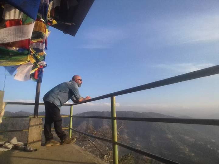
Pour découvrir le Népal pour la première fois, Lhakpa et Migmar m'ont emmené dans des endroits fabuleux autour de Karmandu où je souhaitais rester.

Leur accompagnement m'a complètement sécurisé. Leur bonne humeur et leur professionnalisme sont remarquables, leur amour pour le Népal palpable et leur savoir de tous les us et coutumes absolument ouvert au partage.

Ils m'ont montré librement et joyeusement leur quotidien, me montrant les valeurs du Népal.

Ce fut très inspirant pour moi.
J'espère et je souhaite revenir pour un voyage dans leur village dans les montagnes himalayennes.

Le Népal, c'est génial !
Michele

Michele

voyageur | Experienced Global Guide

Michele is a globetrotter, passionate about travel and cultures, a lover of the voyage of discovery, the one that changes you every time.
He studied tourism in Italy, his country of birth, and has chosen Spain as his home for the last 20 years. He worked for 15 years as a tour guide, leading groups to discover the world, and has lived and worked in countless countries, some of which: Italy, England, Syria, Jordan, 6 years in Egypt, Mexico, Brazil, Thailand, Vietnam, Laos, Cambodia, Greece, and Cuba. He has also been on board cruise ships in the Caribbean but his real passion is backpacking. In 2015 he set off on a six-month trip to Asia, doing solidarity work in every country he touched, his final destination was in the country that has always attracted him for its impressive nature and its fantastic hospitable and smiling people: Nepal. Entering by bus from India in Kakarbhitta on an endless journey to Kathmandu, and when he meets up with Mingmar, sitting on his side, it is friendship at first sight! He falls in love with Nepal immediately and returns several times for trekking, with Mingmar's perfect, tailor-made planning, he works with 2 children's homes that soon become his chosen family and his everlasting link to this beautiful country. What strikes him most about Nepal is the absolute peace, the friendly people, the times to meditate and the incredible spaces where he can get lost and find himself again and again.

📧 michelepiselli@yahoo.it
Carole Desmaris

Carole Desmaris

Grand Voyageuse. Alsace France

"J'ai connu Mingmar en 2012 lors d'un trek au Langtang. Mon premier séjour au Népal via l'agence Allibert. Celui qui m'a le plus marqué et qui m'a donné envie de revenir. Grâce à Mingmar. Il était aux petits soins pour nous, très à l'écoute, toujours souriant, disponible, nous parlant de son pays avec passion et se pliant en quatre pour que notre séjour soit inoubliable. Et il l'a été. En tout point ! Autant sur le plan sportif que sur le plan humain ! Une vraie leçon de vie.

Un témoignage aussi sur sa capacité à réagir et à gérer les imprévus, que ce soit quand notre "sirdar" pour des raisons personnels a dû nous quitter ou lorsqu'un membre du groupe a eu le mal des montagnes. Dans les deux cas, la situation a été gérée avec brio.

Nous sommes toujours restés en contact depuis cette rencontre et avons peu à peu tissé des liens d'amitié.

Partir avec Lhakpa Trekking, compte-tenu de l'expérience passée de son fondateur, est la certitude de vivre un séjour inoubliable, de partager des moments uniques et de revenir avec des étoiles dans les yeux. En toute sécurité. Je recommande !"

📧 cdesmaris@live.fr
Mt Everest | 1st

Mt Everest | 1st

8848.86 m | Nepal-China

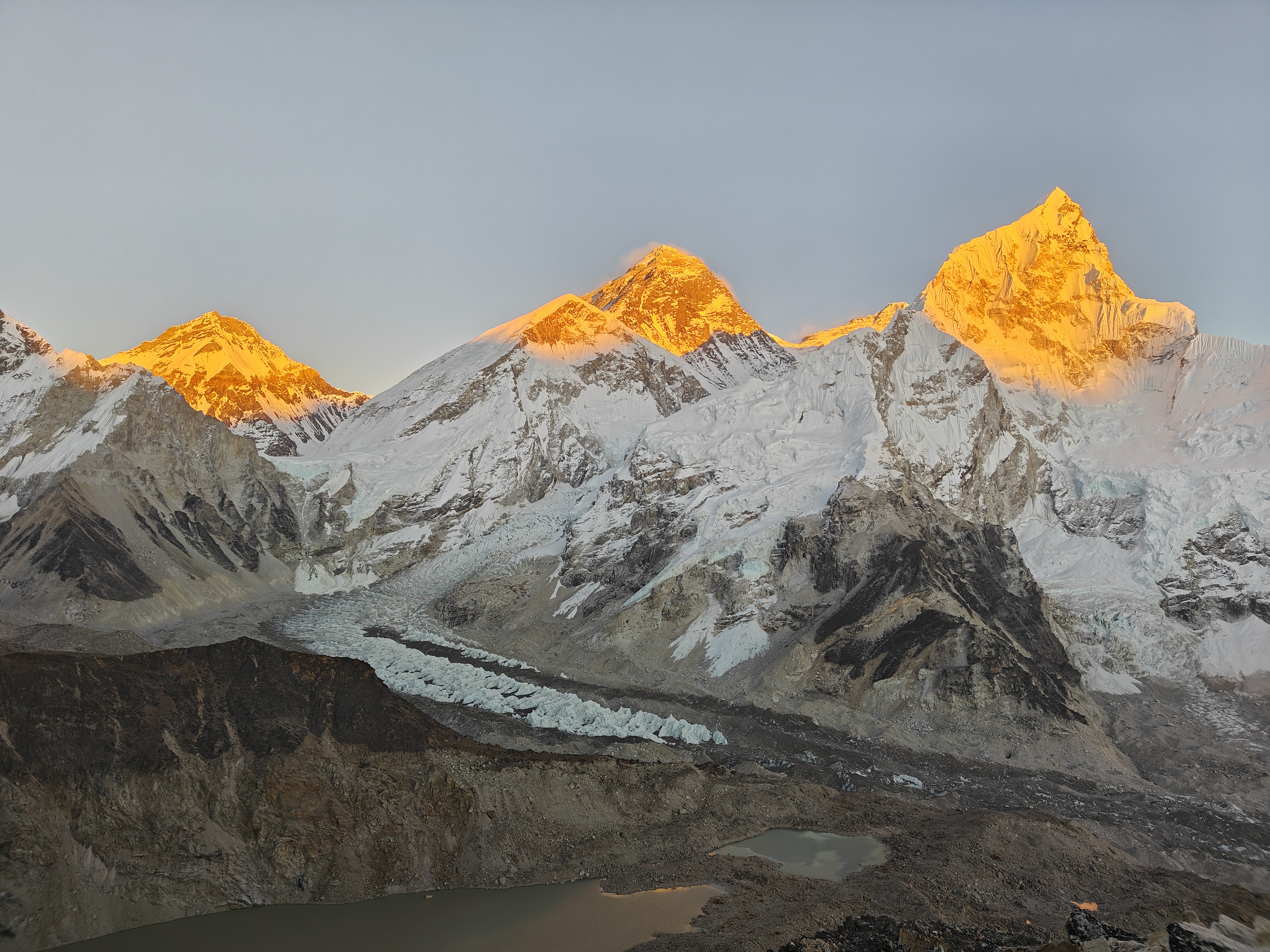
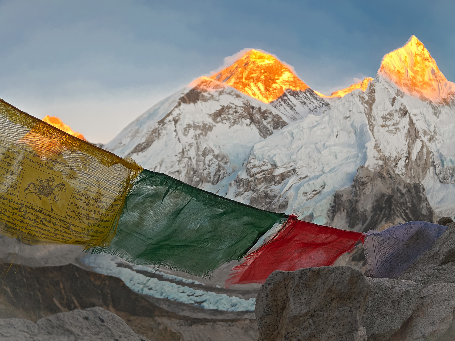
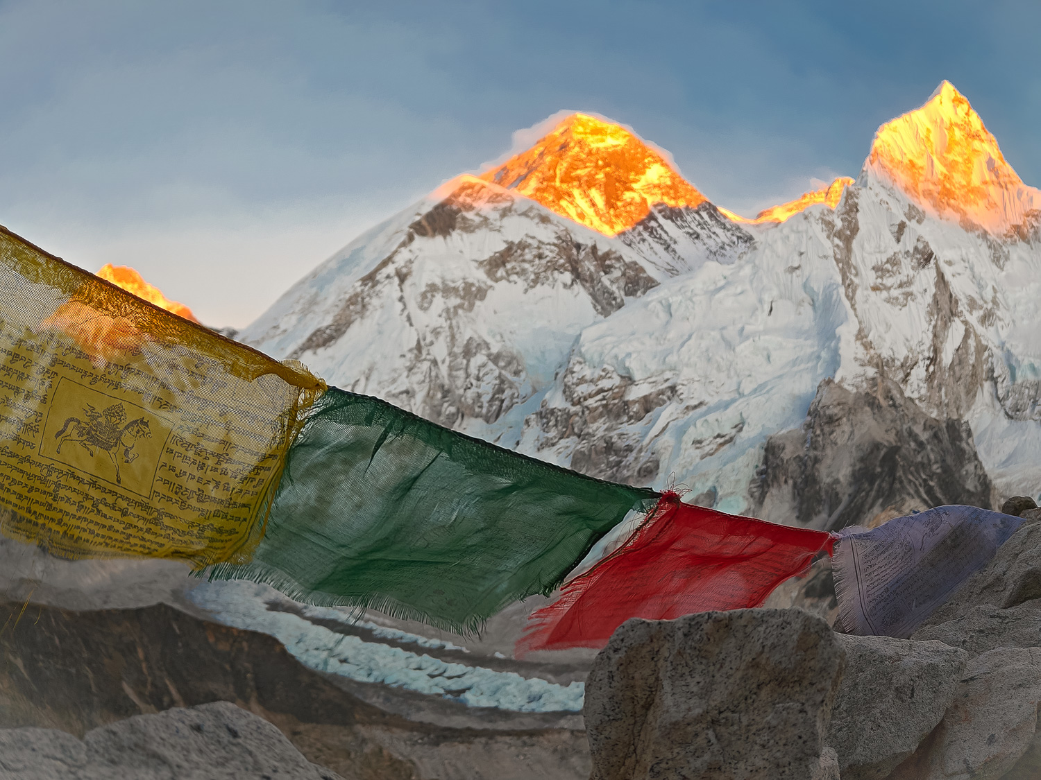
Mount Everest (8,848.86 m), the world’s highest mountain, lies on the border of Nepal and Tibet (China) in the Himalayas. First measured in 1856 during the Great Trigonometric Survey of India as Peak XV, it was officially named in 1865 after Sir George Everest. British expeditions began in the 1920s, including the famous 1924 Mallory-Irvine expedition.\n\nThe first confirmed ascent was achieved on May 29, 1953, by Sir Edmund Hillary and Tenzing Norgay Sherpa. China completed the first ascent from the north side in 1960, while Junko Tabei became the first woman to summit Everest in 1975. In 1993, Pasang Lhamu Sherpa became the first Nepali woman to reach the summit, though she tragically lost her life during the descent.\n\nAs of December 2024, 7,269 individuals have successfully summited Everest, with 12,884 total ascents recorded. Each year, around 700-1,000 climbers attempt the mountain, supported by Sherpas who remain essential to Himalayan mountaineering. Known locally as Sagarmatha in Nepali, Chomolungma in Tibetan, and Qomolangma in Chinese, Everest today stands as a global symbol of adventure, endurance, and human achievement.
Mt.K2 | 2nd

Mt.K2 | 2nd

8,611 m | Pakistan - China

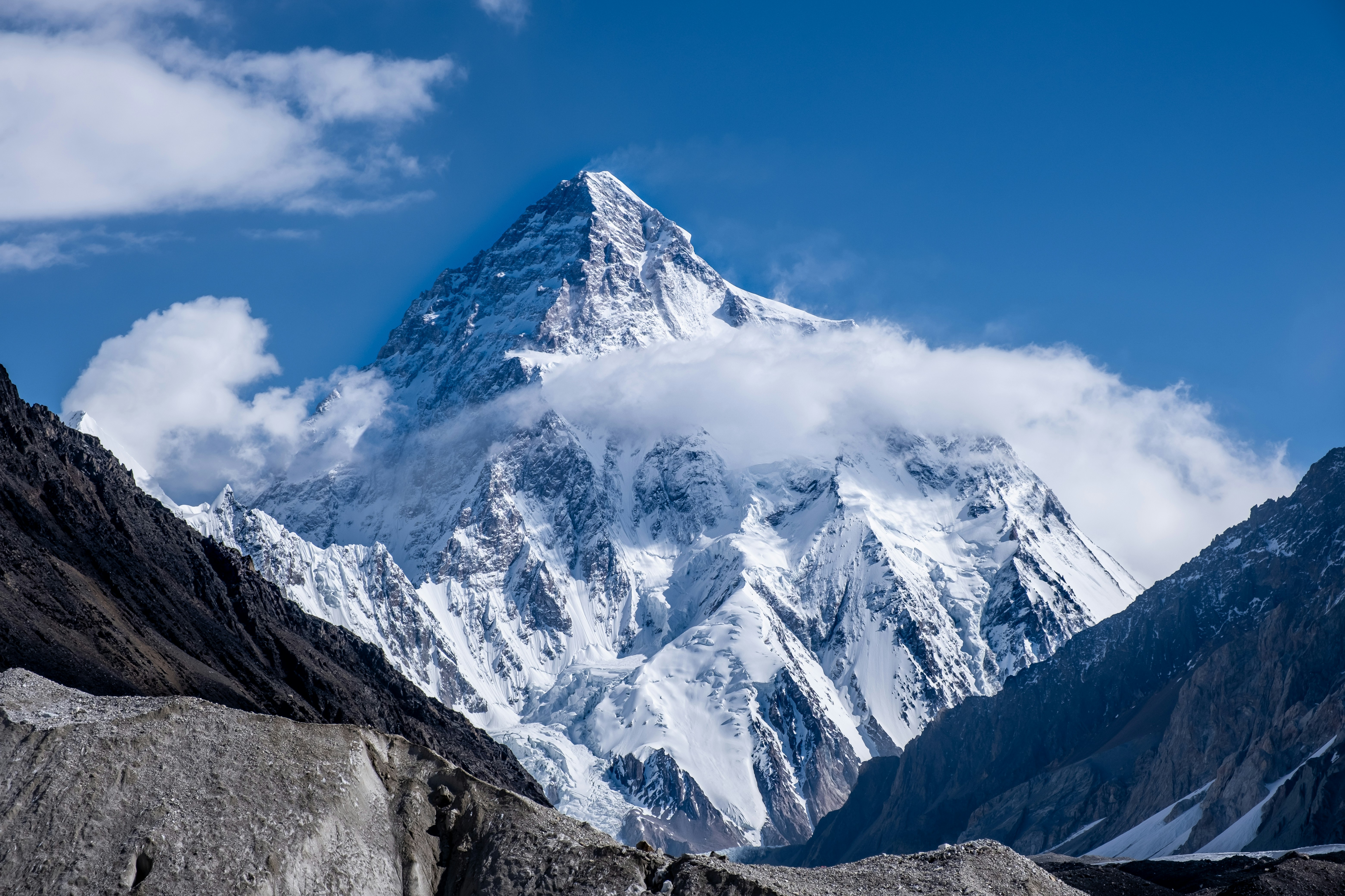
K2 (8,611 m), also known as Mount Godwin-Austen, is the world’s second-highest mountain. It is located in the Karakoram Range on the border of Pakistan’s Gilgit-Baltistan and China’s Xinjiang. In Balti, it is called Chogori, meaning “Great Mountain” or “King of Mountains.” The name K2 was introduced in 1856 by British surveyor Thomas Montgomerie during the Great Trigonometric Survey of India, identifying it as the second Karakoram peak.\n\nNicknamed the “Savage Mountain,” K2 is notorious for its difficulty, harsh weather, and high fatality rate. Early 20th-century expeditions failed, but on July 31, 1954, Italians Achille Compagnoni and Lino Lacedelli, led by Ardito Desio, made the first ascent. With no easy route, all approaches are technically demanding, and it is climbed far less often than Everest, widely regarded as the ultimate mountaineering challenge.\n\nLocal names: Chogori (Balti), K2 (survey name, 1856), Mount Godwin-Austen (rarely used).
Kangchenjunga | 3rd

Kangchenjunga | 3rd

8,586 m | Nepal - India

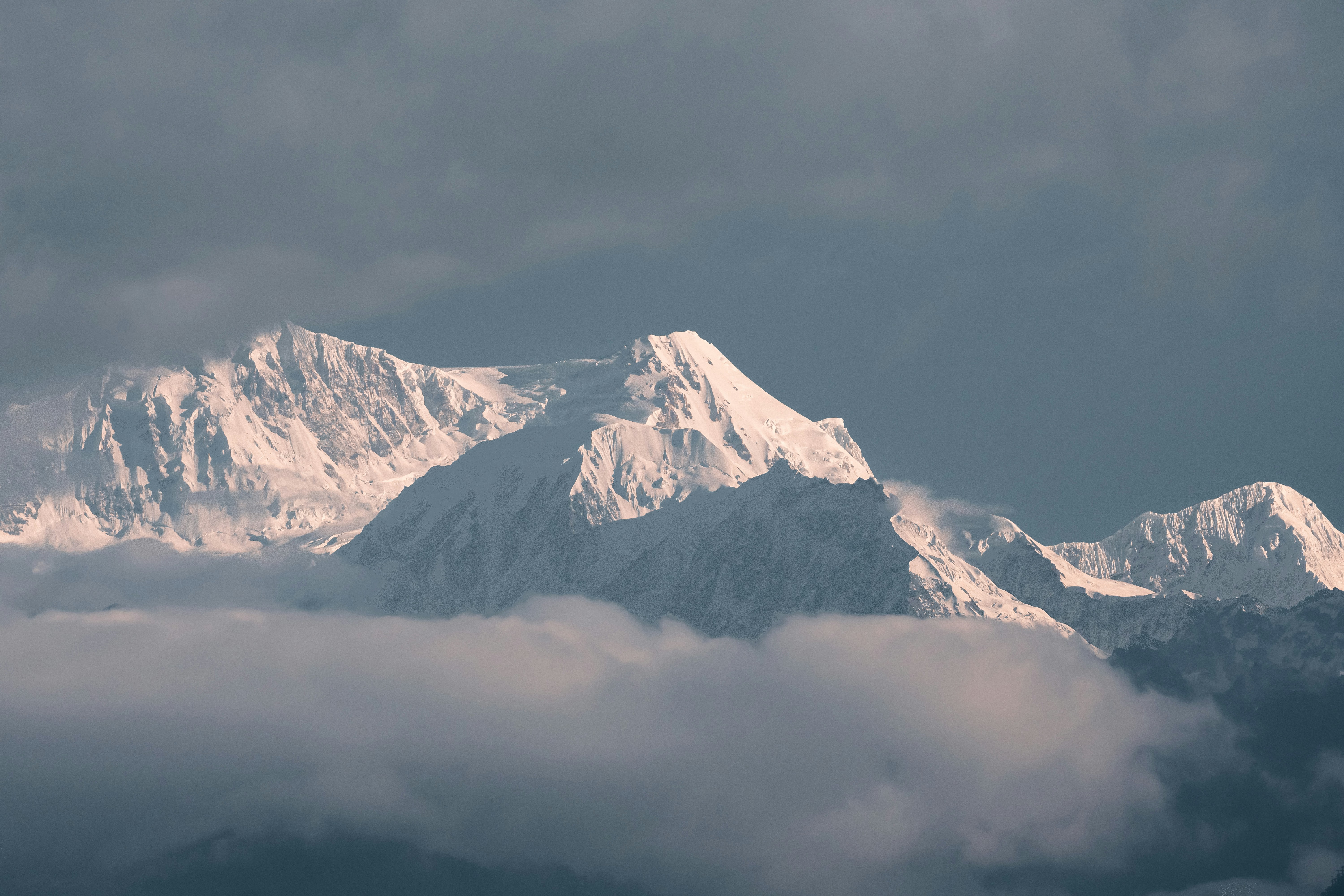
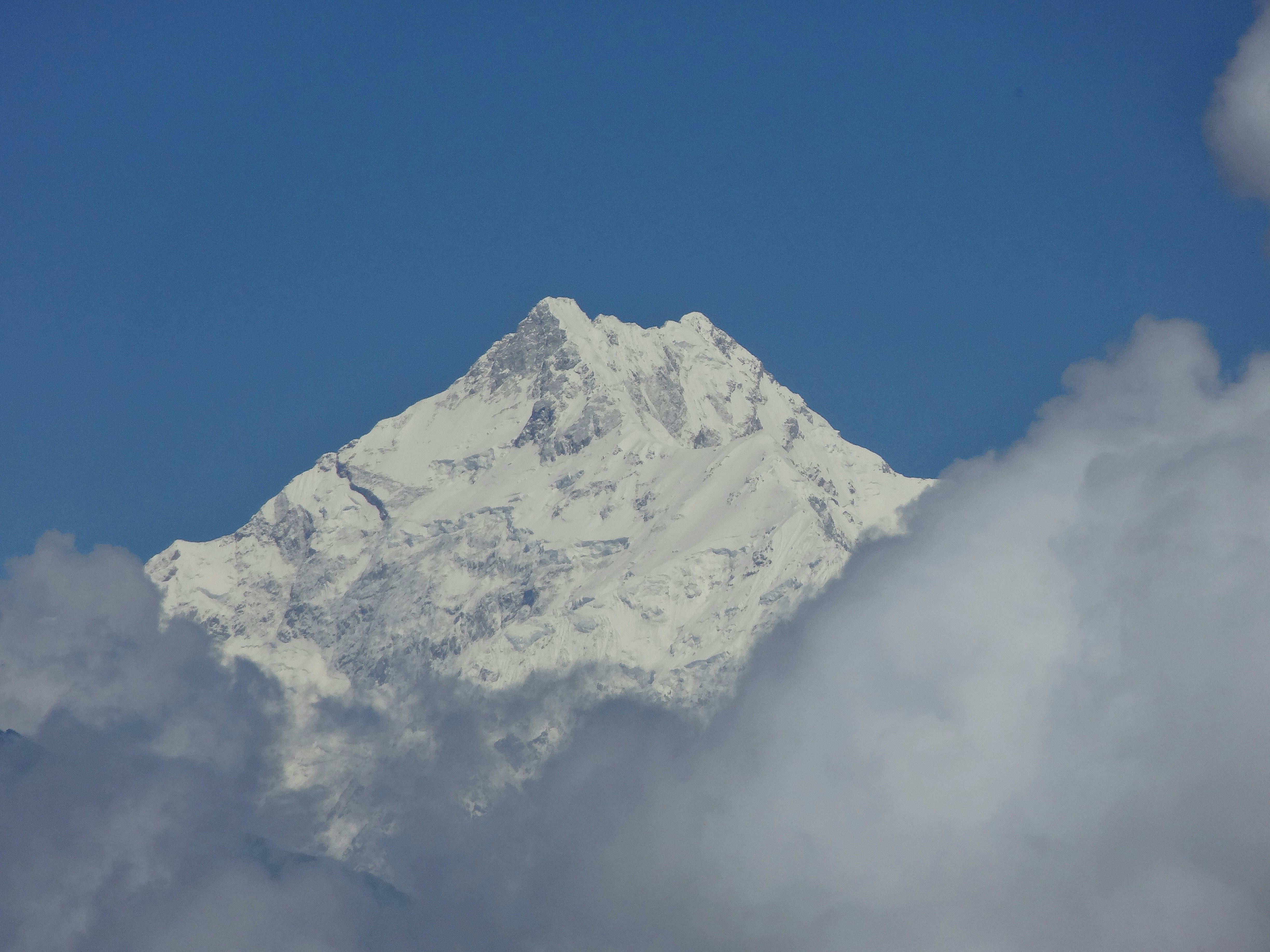
Kanchenjunga (8,586 m), the world’s third-highest mountain, lies on the border of Nepal and India (Sikkim) in the Himalayas. Its Tibetan name, Kangchen Dzö-nga, means “Five Treasures of the Great Snow,” referring to gold, silver, gems, grain, and holy books believed to be hidden in its five peaks. Revered as sacred in Sikkimese culture, it is considered the abode of the gods, and climbers traditionally avoid stepping on the very summit.\n\nFirst surveyed by the British in the mid-19th century, Kangchenjunga proved difficult due to its remoteness, steep terrain, and severe weather. On May 25, 1955, a British expedition led by Charles Evans achieved the first ascent, with Joe Brown and George Band reaching the summit but stopping short to respect local beliefs. Today, Kangchenjunga remains one of the most remote, sacred, and technically demanding peaks in the world.
MT. Lhotse | 4rth

MT. Lhotse | 4rth

8,586 m | Nepal - Tibet (China)

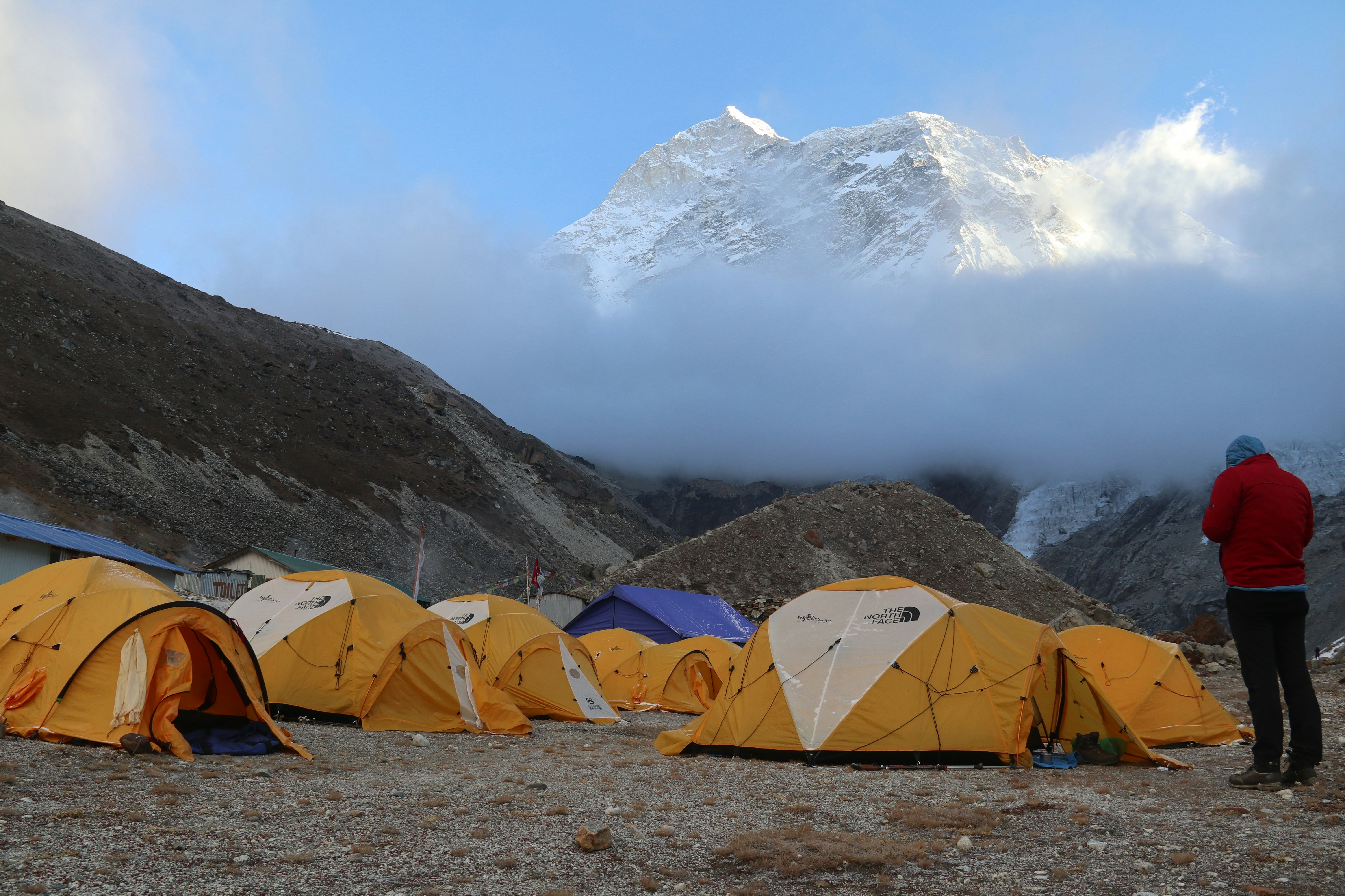
Lhotse (8,516 m), the world’s fourth-highest mountain, lies on the Nepal-Tibet (China) border, just south of Everest. Its Tibetan name means “South Peak,” reflecting its position as part of the Everest massif, connected via the South Col. Known for the steep and difficult Lhotse Face, it is regarded as one of the most demanding Himalayan peaks.\n\nFirst surveyed in the mid-19th century during the Great Trigonometric Survey of India, it was first climbed on May 18, 1956, by Swiss climbers Ernst Reiss and Fritz Luchsinger. By March 2012, Lhotse had seen 461 successful ascents (371 by 2008), with no summits between 2014 and 2016 due to accidents. The most recent ascent was in May 2025 by Lin Zhiyong and Dipan Gurung.
MT. Makalu | 5th

MT. Makalu | 5th

8,481 m | Nepal - China

Makalu (8,481 m) is the fifth-highest mountain in the world, situated on the Nepal and China border. Its name is derived from the Sanskrit term “Maha Kala,” meaning “Great Black Mountain.” Makalu was first ascended in 1955 by the French climbers Jean Couzy and Lionel Terray. The mountain is renowned for its pyramidal shape, sharp ridges, and steep faces, making it one of the most technically challenging peaks in the world. Located approximately 19 km southeast of Mount Everest, Makalu remains remote, pristine, and less frequently climbed.\n\nMakalu is one of the most challenging 8,000-meter peaks, with a general success rate of around 9% (2012 NASA data). By 2022, there were 206 successful ascents. In the Spring 2025 season, the route opened on April 10, and teams - including an Indian ITBP group and an Australian climber - reached the summit in mid-April and early May.
MT. Cho Oyu | 6th

MT. Cho Oyu | 6th

8,188 m | Nepal - China

Cho Oyu (8,188 m) is the sixth-highest mountain in the world, located on the Nepal-China border. The local name of Cho Oyu is “Chowang Yü” in Tibetan, which means “Turquoise Goddess.” It was first climbed in 1954 by Herbert Tichy, Joseph Jöchler, and Pasang Dawa Lama. Cho Oyu is known for its gentler slopes, making it one of the more accessible 8,000-meter peaks, though it remains challenging due to altitude and weather. It is situated west of Mount Everest in the Himalayas.\n\nThere are no exact statistics on failed Cho Oyu attempts, but it has over 3,800 successful summits. In recent years, higher permit costs, Chinese visa difficulties, and the challenging south-face route have made climbs harder, especially after the Covid-19 pandemic. It has a low death-to-summit ratio compared to other 8,000-meter peaks. The most recent notable climb was the first recorded summit from the Nepalese side in June 2024
Mt.Dhaulagiri I | 7th

Mt.Dhaulagiri I | 7th

8,167 m | Nepal

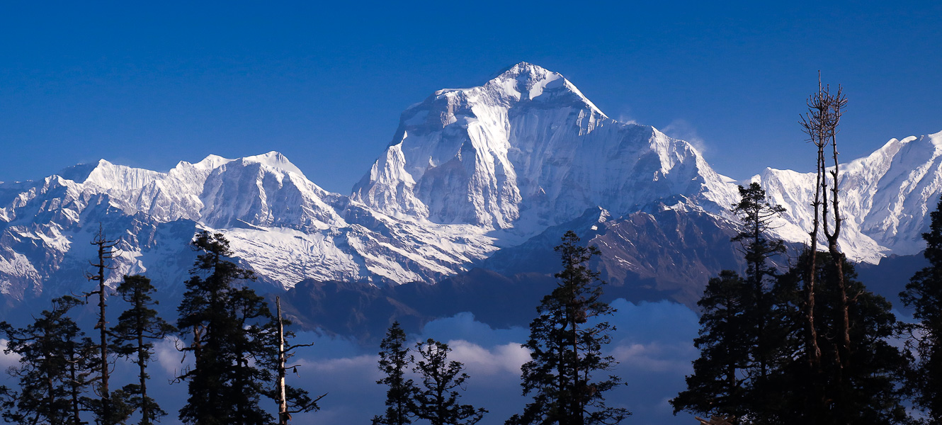
Dhaulagiri, the seventh-highest mountain in the world at 8,167 meters, is in central Nepal. Its name means “White Mountain” in Sanskrit, reflecting its snow-covered peaks.\n\nAlthough surveyed in the 19th century, it was first successfully climbed on 13 May 1960 by a Swiss-Austrian-German team; Kurt Diemberger, Peter Diener, Ernst Forrer, and Albin Schelbert, assisted by Sherpas Nawang Dorje and Nima Dorje. Dhaulagiri remains a challenging peak due to steep slopes, avalanches, and unpredictable weather.\n\nAs of May 2025, a total of 680 climbers have successfully summited Dhaulagiri, the world’s seventh-highest peak, since its first ascent in 1960. This includes 42 climbers who reached the summit in 2024 and early 2025 - 29 in 2024 and 13 in 2025. By the end of 2023, 638 climbers had already reached the top, bringing the overall total to 680
MT. Manaslu | 8th

MT. Manaslu | 8th

8,163 m | Nepal

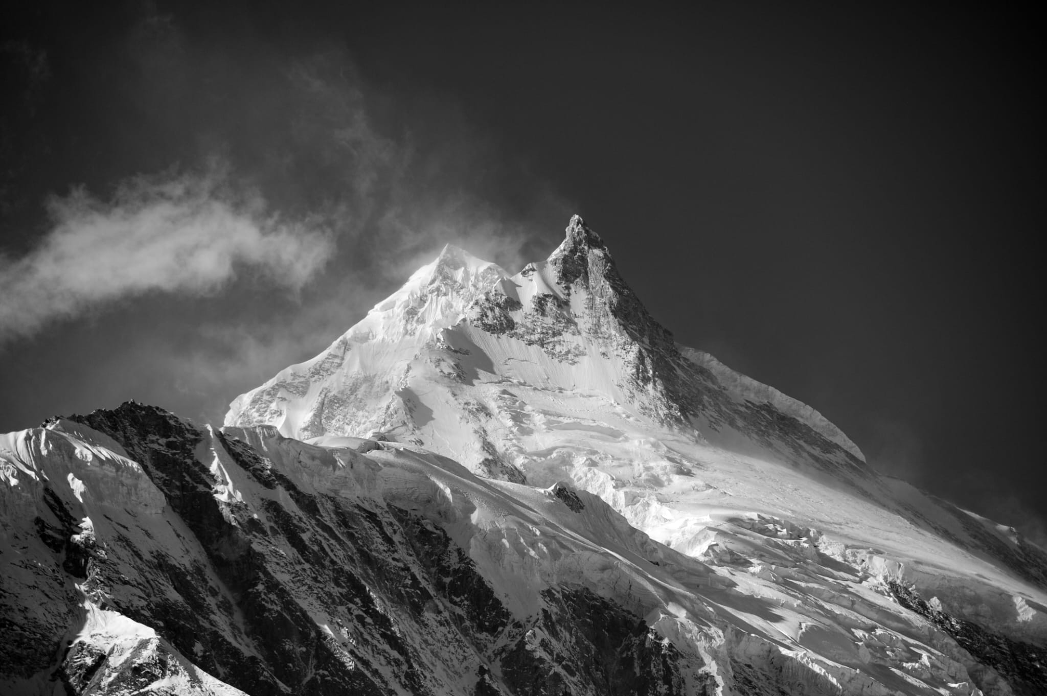
Manaslu (8,163 m) is the eighth-highest mountain in the world, located in Nepal. Its name derives from the Sanskrit word “Manasa”, meaning spirit or soul, earning it the nickname “Mountain of the Spirit.” The first successful ascent was on 9 May 1956 by a Japanese team including Toshio Imanishi and Sherpa Gyalzen Norbu. Known for its long ridges, glaciated terrain, and challenging weather, Manaslu is a demanding climb attracting mountaineers worldwide. Most expeditions occur in autumn, with some in spring and winter.\n\nBy the end of 2023, 3,317 climbers had reached the summit (including foresummit), and 843 climbed without bottled oxygen. Seasonal totals: autumn 2,983, spring 312, winter 22, making autumn the most favored. Manaslu offers a challenging and adventurous experience for both experienced climbers and beginners.
MT. Nanga Parbat | 9th

MT. Nanga Parbat | 9th

8,126 m | Pakistan

Nanga Parbat, the ninth-highest mountain in the world at 8,126 meters, is located in Pakistan. Its name means “Naked Mountain” in Persian, reflecting its steep, exposed slopes.\n\nThe first successful ascent was made on 3 July 1953 by Hermann Buhl. The mountain is notorious for its extreme difficulty, massive vertical relief, and avalanche-prone terrain, earning it the nickname “Killer Mountain”. Approximately 400 mountaineers have successfully summited Nanga Parbat to date, with climbing becoming more frequent over the years, though it remains a highly challenging and dangerous peak. In July 2023, reports recorded over 60 summits in that month alone. By 2023, approximately 400 individual mountaineers had successfully summited Nanga Parbat. Successful ascents are rare, and the total number of attempts far exceeds the number of successful summits. The mountain has a history of high fatalities, with a mortality rate that fluctuated from 77% before 1990 to between 20.7% and 22%.
MT. Annapurna I | 10th

MT. Annapurna I | 10th

8,091 m | Nepal

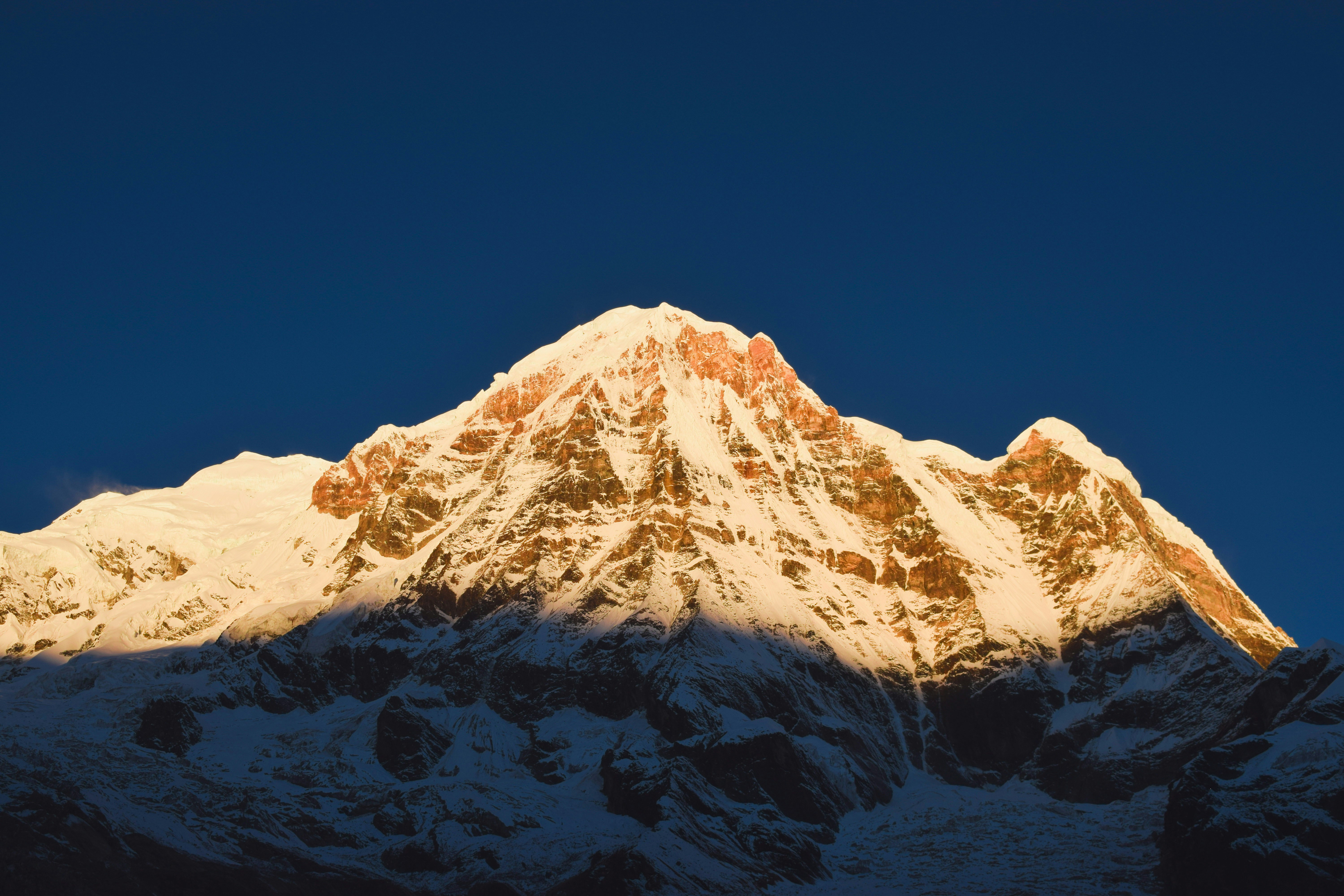
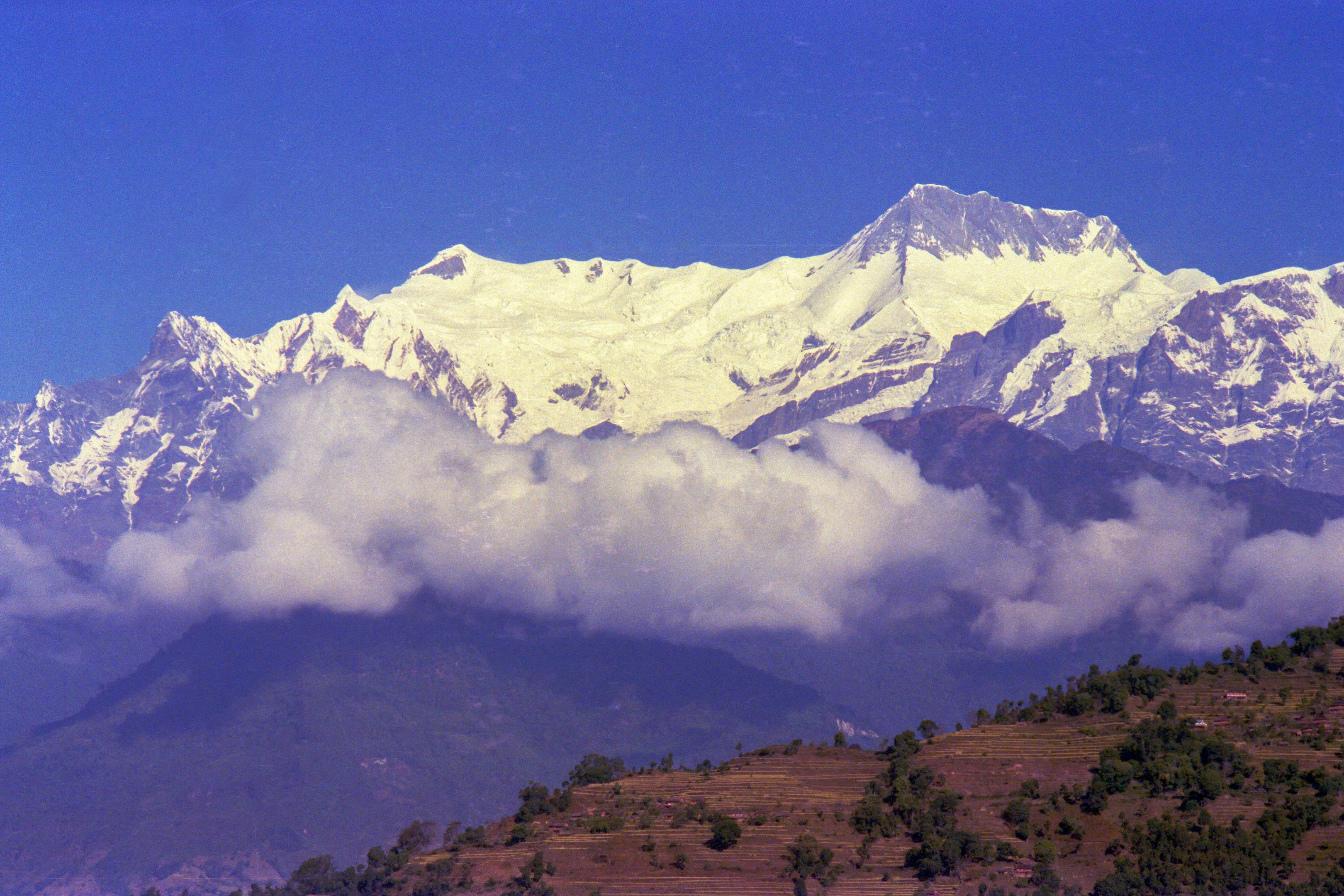
Annapurna I, the tenth-highest mountain in the world at 8,091 meters, is located in Nepal. Its name comes from Sanskrit, meaning “Goddess of Harvests”, symbolizing abundance and nourishment.\n\nThe mountain was first successfully climbed on 3 June 1950 by a French expedition led by Maurice Herzog and Louis Lachenal. Annapurna I is known for its steep faces, avalanche-prone slopes, and technical difficulty, making it one of the most challenging of the 8,000-meter peaks. Despite its dangers, it has a long history of mountaineering and remains a coveted summit for climbers worldwide.\n\nAs of early April 2025, 514 climbers have successfully summited Annapurna I, including 310 expedition members and 204 Sherpas, according to Alan Arnette citing the Himalayan Database. Annapurna I is known for being a particularly dangerous and challenging peak, with a lower success rate and higher fatality rate compared to Mount Everest, making each successful ascent a remarkable achievement of skill and perseverance.
MT. Gasherbrum I | 11th

MT. Gasherbrum I | 11th

8,080 m | Pakistan - China

Gasherbrum I, the eleventh-highest mountain in the world at 8,080 meters, is located on the border of Pakistan and China in the Karakoram range. It is also called “Hidden Peak” because of its remote location.\n\nThe mountain was first successfully climbed on 5 July 1958 by an American expedition, with climbers Pete Schoening and Andy Kauffman reaching the summit. Gasherbrum I is known for its technical difficulty, harsh weather, and remote access, making it a challenging peak even for experienced mountaineers.\n\nThe collection of data for every successful summit on such remote peaks is not always meticulously kept or easily accessible, making a precise count difficult to ascertain. it is estimated to be less than 200, reflecting its challenging nature. For example, there were 17 successful ascents during the summer of 2025 alone, according to mountaineer Alan Arnette.
MT. Broad Peak | 12th

MT. Broad Peak | 12th

8,051 m | Pakistan - China

Broad Peak, the twelfth-highest mountain in the world at 8,051 meters, is located on the border of Pakistan and China in the Karakoram range. It is also known as Falchan Kangri.\n\nThe first successful ascent was made on 9 June 1957 by an Austrian expedition, with climbers Fritz Wintersteller, Marcus Schmuck, Kurt Diemberger, and Hermann Buhl reaching the summit. Broad Peak is known for its long summit ridge, technical challenges, and harsh weather, making it a demanding climb for mountaineers.\n\nAs of early April 2025, approximately 404 climbers have successfully summited Broad Peak (8,051 m), including its sub-peaks.
MT. Gasherbrum II | 13th

MT. Gasherbrum II | 13th

8,034 m | Pakistan - China

Gasherbrum II (8,034 m), the thirteenth-highest mountain in the world, is located on the border of Pakistan and China in the Karakoram range. Also called K4, it was first successfully climbed on 7 July 1956 by an Austrian team: Fritz Moravec, Josef Larch, and Hans Willenpart.\n\nConsidered one of the easier 8,000-meter peaks technically, Gasherbrum II has seen many commercial expeditions, with hundreds of climbers reaching the summit over the years.\n\nThe total number of successful ascents of Gasherbrum II is not precisely known, but it is estimated to be several hundred since the first ascent in 1956. Hundreds of climbers attempt the peak each year. In July 2023, several expeditions reported 30-40 climbers reaching the summit on different days, with at least 6-16 foreign climbers summiting on single days..
MT. Shishapangma | 14th

MT. Shishapangma | 14th

8,027 m | China

Shishapangma, the fourteenth-highest mountain in the world at 8,027 meters, is located entirely in Tibet, China. Its local name, Gosainthān, means “Place of the Gods.”\n\nThe first successful ascent was on 2 May 1964 by a Chinese expedition led by Xǔ Jìng. Shishapangma is considered one of the more accessible 8,000-meter peaks due to its relatively gentle slopes, though it still poses significant challenges such as high altitude, crevasses, and unpredictable weather.\n\nAs of early 2025, the exact total number of successful ascents of Shishapangma is not precisely known due to limited and inconsistent reporting. By 2003, there were about 201 successful ascents to the main summit, with 19 fatalities, and by 2012, this had increased to 302 ascents with 25 fatalities. In 2008, the central summit had been reached over 750 times, though only around 50 climbers continued to the main summit. These figures indicate a gradual increase in successful climbs over the years. However, due to highly restricted permits issued by Chinese and Tibetan authorities, obtaining comprehensive and up-to-date statistics remains difficult.
MT. Gyachung Kang | 1st

MT. Gyachung Kang | 1st

7,952 m | Nepal - Tibet

Gyachung Kang (7,952 m), also called Gyachung Khang, is the highest mountain below 8,000 meters and the 15th highest in the world. It lies in the Mahalangur Himal range on the Nepal-Tibet border, between Mount Everest and Cho Oyu. Its name comes from Sherpa and Tibetan traditions, though its exact meaning is unclear. The first ascent was on April 10-11, 1964 by a Japanese team: Yukihiko Kato, Kiyoto Sakaizawa, Pasang Phutar, K. Machida, and K. Yasuhisa. The expedition suffered a tragedy when Akio Otaki fell at ~7,750 meters and died.\n\nIn 1986, a French-Nepali team led by Jean-Claude Marmier made the first ascent without supplemental oxygen via the South Face and Southwest Pillar. In 1988, a South Korean team summited via the Southwest Face and Southwest Ridge. Despite its height, Gyachung Kang has had few ascents due to remoteness and technical difficulty. The exact number of successful ascents is not publicly recorded, but ongoing attempts are confirmed by tour operators and expedition companies since 1964.
MT. Annapurna II | 2nd

MT. Annapurna II | 2nd

7,937 m | Nepal

Annapurna II (7,937 m) is the easternmost peak of the Annapurna range in Nepal and the second-highest in the Annapurna massif after Annapurna I. It is the 16th-highest mountain in the world. Its name comes from Sanskrit, meaning “Goddess of the Harvests” or “Full of Food,” symbolizing nourishment and abundance. The first ascent was on May 17, 1960, by a British/Indian/Nepali team led by J. O. M. Roberts, with Richard Grant, Chris Bonington, and Ang Nyima reaching the summit. Annapurna II is known for its steep faces and avalanche-prone slopes, making it a serious and challenging climb. It has been climbed less frequently than other peaks of similar height, with fewer than 20 successful ascents.\n\nMost expeditions follow the northwest ridge, the original 1960 route, though alternative lines have been attempted. Its technical difficulty and relative obscurity keep it among the less-visited high Himalayan summits.
MT. Gasherbrum IV | 3rd

MT. Gasherbrum IV | 3rd

7,925 m | Pakistan - China

Gasherbrum IV (7,925 m), the 17th-highest mountain in the world, is in the Karakoram range on the Pakistan-China border. Its Balti name means “beautiful mountain” and is often called the “Shining Wall” due to its dramatic 2,500-meter west face. The first ascent was on August 6, 1958, by Walter Bonatti and Carlo Mauri via the Northeast Ridge, establishing its mountaineering fame.\n\nIn 1985, Robert Schauer and Wojciech Kurtyka made the first West Face ascent in alpine style, a landmark Himalayan achievement. Despite being below 8,000 meters, Gasherbrum IV is extremely challenging due to steep ridges, complex ice and rock routes, and severe weather. It is rarely climbed and remains one of the most respected major peaks in the Karakoram.
MT. Himalchuli | 4rth

MT. Himalchuli | 4rth

7,893 m | Nepal

Himalchuli (7,893 m) is the second-highest peak of the Manaslu Himal in Nepal and the 18th-highest mountain in the world. The name comes from “Himal” (snow mountain) and “Chuli” (peak), meaning “Snow Peak.” It has three main summits: Himalchuli Main (7,893 m), Himalchuli West (7,540 m), and Himalchuli East (7,893 m).\n\nThe first ascent was made on May 24, 1960, by a Japanese team led by Hisashi Tanabe, with climbers Hisashi Tanabe and Masahiro Harada reaching the summit via the southeast face. The mountain is considered very difficult because of steep slopes, technical ice and rock sections, and avalanche danger.\n\nAlthough one of Nepal’s highest peaks, Himalchuli has seen very few ascents since 1960 and remains one of the least-climbed major mountains in the Himalayas.
MT. Distaghil Sar | 5th

MT. Distaghil Sar | 5th

7,885 m | Pakistan

Distaghil Sar (7,885 m) is the highest peak of the Hispar Muztagh subrange in the Karakoram, located in Pakistan. The name comes from local Wakhi or Balti language, though its exact meaning is not clearly documented.\n\nThe first ascent was made on July 9, 1960, by a German-Austrian expedition led by Günther Stöckl. The summit team included Helmut Heuberger, Rainer Goeschl, and Hans Maier. The climb was achieved via the south ridge, which remains the standard route.\n\nDistaghil Sar is considered highly challenging due to steep faces, crevassed glaciers, and unpredictable weather. Despite its height, it is rarely climbed, with only a few successful expeditions since 1960.
MT. Ngadi Chuli | 6th

MT. Ngadi Chuli | 6th

7,871 m | Nepal

Ngadi Chuli (7,871 m), also known as Peak 29, is part of the Himalaya in Nepal and the 20th-highest mountain in the world. Its name, Ngadi Chuli, comes from local Nepali and Tibetan languages, though the exact meaning is not well documented.\n\nThe first and only confirmed ascent was made on May 1979 by a Japanese expedition led by Kenji Kobayashi, who reached the summit with Naoki Takahashi. The mountain is extremely remote and technically demanding, featuring steep ice and rock faces, unstable snow conditions, and high avalanche risk. Ngadi Chuli remains one of the least-climbed high Himalayan peaks, with very few attempts recorded, making it one of the most difficult mountains to summit in Nepal.
MT. Nuptse | 7th

MT. Nuptse | 7th

7,861 m | Nepal

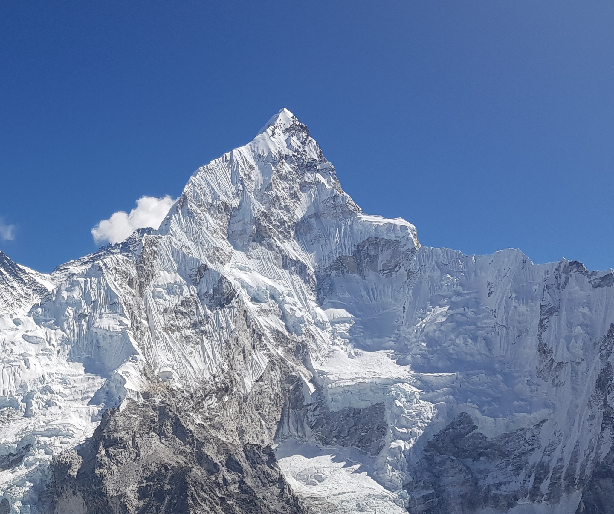
Nuptse (7,861 m) is a prominent peak in the Khumbu region of Nepal, located just southwest of Mount Everest. Its name, Nuptse, means West Peak in Tibetan, reflecting its position as part of the Everest massif.\n\nThe first ascent was made on May 16, 1961, by a British expedition led by Joe Brown and George Band. Climbers Dennis Davis, Sherpa Tashi, and Sherpa Dorje were part of the team that reached the summit via the south ridge.\n\nNuptse is known for its steep, rugged slopes and technical climbing challenges, including exposed ridges and unstable ice faces. Although it is lower than its Everest neighbor, it remains a difficult and rarely climbed peak compared to other mountains in the region, with relatively few successful ascents.
MT. Khunyang Chhish | 8th

MT. Khunyang Chhish | 8th

7,823 m | Pakistan

Khunyang Chhish (7,823 m), also spelled Kunyang Chhish, is a major peak in the Hispar Muztagh subrange of the Karakoram mountains in Pakistan. Locally, it is known as “Corner Peak”, reflecting its prominent position in the region.\n\nThe first successful ascent was made in 1971 by a Polish expedition led by Andrzej Zawada, who reached the summit via the south ridge, which remains the standard route. The peak is extremely challenging due to its steep slopes, technical ice and rock sections, unpredictable weather, and remote location, which requires complex logistics and long approaches. Khunyang Chhish has been successfully summited only a handful of times, making it one of the least-climbed major mountains in the Karakoram. Its East Summit (7,400 m) was first climbed in 2013 by Hansjörg Auer, Matthias Auer, and Simon Anthamatten, but the main summit remains a formidable and rarely attempted challenge.
MT. Masherbrum (K1) | 9th

MT. Masherbrum (K1) | 9th

7,821 m | Pakistan

Masherbrum (K1) (7,821 m) is a prominent peak in the Karakoram range of Pakistan. The name Masherbrum comes from the Balti language, meaning “Mather Mountain”. It was the first peak surveyed in the Karakoram during the British 1856 survey, initially labeled as K1. The first successful ascent was on July 14, 1955, by a British-Pakistani expedition led by George Band, who reached the summit with Tony Streather. Masherbrum is known for its steep and technically demanding slopes, including mixed ice and rock routes. Despite its height being slightly lower than some neighboring peaks like K2, it remains a challenging climb and is much less frequented, offering a remote and personal mountaineering experience.
MT. Nanda Devi | 10th

MT. Nanda Devi | 10th

7,816 m | India

Nanda Devi (7,816 m) is India’s second-highest mountain, located in the Garhwal Himalayas of Uttarakhand. Its name, meaning “Bliss-Giving Goddess” in Sanskrit, reflects the mountain’s spiritual and cultural significance. The first successful ascent was made on August 29, 1936, by a British-Indian expedition led by Noel Odell, with climbers navigating steep ridges and avalanche-prone slopes. Today, Nanda Devi is largely protected within the Nanda Devi Sanctuary, and climbing is strictly regulated, making successful summits rare. Its sharp peaks, snow-covered faces, and technical challenges continue to make it one of the most respected and least-climbed high Himalayan mountains.
MT. Kamet | 11th

MT. Kamet | 11th

7,756 m | India

Mount Kamet (7,756 m) is the third-highest mountain in India and part of the Garhwal Himalayas in Uttarakhand, near the border with Tibet (China). It was first climbed in 1931 by Frank Smythe, along with a British expedition team. Kamet is known for its imposing height, steep ridges, and glaciers, making it a challenging climb despite being lower than the 8,000-meter peaks. The mountain is surrounded by important trekking routes and high-altitude passes, such as the Nanda Devi Sanctuary region. Its relatively remote location and technical terrain mean that ascents are less frequent compared to more popular Himalayan peaks.\n\nThe local name of Mount Kamet is typically just “Kamet”, which comes from the Tibetan word “Kang Meni”, meaning something like “Mountain of the God” or “Divine Mountain.” It is recognized by local Garhwali and Tibetan communities with reverence, reflecting both its spiritual significance and its towering presence in the Garhwal Himalayas.
MT. Mount Gongga | 12th

MT. Mount Gongga | 12th

7,556 m | China - Sichuan

Mount Gongga (7,556 m), also known as Minya Konka, is the highest peak in Sichuan Province, China, located in the Daxue Shan range on the eastern edge of the Tibetan Plateau. Its Tibetan name, Mi'nyâg Gong'ga Riwo, translates to “White Ice Mountain of Minyang”, reflecting both its striking appearance and cultural significance.\n\nThe first successful ascent was made on October 28, 1932, by American climbers Terris Moore and Richard Burdsall via the northwest ridge. Mount Gongga is renowned for its steep slopes, technical terrain, and unpredictable weather, making it one of the most challenging 7,000-meter peaks in the world. Its climbing history includes several tragic expeditions, and the total number of successful summits remains relatively low, highlighting the mountain’s formidable difficulty and remote location.
MT. Changtse | 13th

MT. Changtse | 13th

7,543 m | Tibet, near Everest

Changtse (7,543 m) is a major peak in Tibet, just north of Mount Everest. Its name means “North Peak” in Tibetan. The first official ascent was on October 14, 1982, by a German expedition via the northeast ridge. Since then, a few international teams have reached the summit, including a Chinese-Japanese team in 1986, which included the first woman to climb Changtse.\n\nThe mountain is technically challenging with steep slopes and unpredictable weather, and it remains one of the less-climbed 7,000-meter peaks in the region, offering a remote alternative to nearby Everest.
MT. Mount Kongur | 14th

MT. Mount Kongur | 14th

7,649 m | China

Mount Kongur (7,649 m) is the highest peak of the Kongur Shan range in Xinjiang, China. Its name comes from the local Uyghur language, meaning “White Peak”, reflecting its snow-covered summit. The first successful ascent was made in July 1981 by a Chinese expedition led by Xu Jing, who reached the summit via the northwest ridge. Mount Kongur is technically demanding, with steep rock and ice faces, glaciated slopes, and unpredictable weather. Its remote location in western China and challenging terrain have limited the number of expeditions, making it one of the less-frequented 7,000-meter peaks in the world.
MT. Trivor | 15th

MT. Trivor | 15th

7,577 m | Pakistan

Mount Trivor, also known as Trivor Sar, is a 7,577-meter peak located in the Hispar Muztagh subrange of the Karakoram in Gilgit-Baltistan, Pakistan. The name “Trivor” is widely used in English and Urdu sources, and while it is sometimes written as Trivor Sar, no distinct indigenous local name has been documented. The mountain was first successfully climbed on August 17, 1960, by Wilfrid Noyce of the United Kingdom and Jack Sadler of the United States via the northwest ridge. The only other confirmed ascent came much later, on August 30, 1991, when a Japanese team led by Toshifumi Onuki and Atsushi Endo reached the summit from the north side through the Momhil Glacier, joining the same northwest ridge.\n\nRecords indicate that Trivor has been summited only twice, making it one of the lesser-climbed high peaks of the Karakoram despite its prominence and beauty.
MT. Baintha Brakk | 16th

MT. Baintha Brakk | 16th

7,285 m | Pakistan

Baintha Brakk (7,285 m), popularly known as The Ogre, is a prominent peak in the Batura Muztagh subrange of the Karakoram in Pakistan. Its local name comes from Balti language traditions, though the meaning is not precisely documented. The first successful ascent was made on August 13, 1977, by a British-New Zealand team led by Chris Bonington, with climbers Doug Scott and Joe Tasker reaching the summit.\n\nBaintha Brakk is infamous for its extreme technical difficulty, featuring steep rock faces, ice towers, and unstable snow, making it one of the most challenging mountains in the Karakoram. Due to its remoteness and high risk, the peak has seen only a handful of successful ascents, and it remains one of the least-climbed 7,000-meter peaks in the world.
MT. Jitchu Drake | 17th

MT. Jitchu Drake | 17th

7,326 m | Bhutan

Jitchu Drake (7,326 m) is a prominent peak located on the Bhutan-Tibet border. Its name comes from Tibetan, often interpreted as “The Horse of the Deity”, reflecting the mountain’s religious significance in Bhutanese culture. The first recorded ascent was made in 1983 by a Japanese expedition.\n\nJitchu Drake is technically demanding, featuring steep ice and rock faces, and access is limited due to both its remote location and Bhutan’s restrictions on climbing sacred peaks. As a result, it has seen very few successful ascents, making it one of the most challenging and rarely attempted 7,000-meter mountains in the Himalayas.
MT. Chomo Lhari | 18th

MT. Chomo Lhari | 18th

7,326 m | Bhutan - Tibet

Chomo Lhari (7,326 m), also known as Jomolhari, is a major mountain on the Bhutan-Tibet border. Its name means “Mountain of the Goddess” in Tibetan, reflecting its spiritual significance in both regions. The first ascent was achieved on May 6, 1937, by a British expedition led by Freddie Spencer Chapman.\n\nChomo Lhari is highly technical, featuring steep ice and rock faces, and access is challenging due to its remote location. Climbing is further restricted in Bhutan because of the mountain’s religious importance, making it one of the least-attempted peaks in the Himalayas while remaining a revered and iconic summit for mountaineers and local communities alike.
MT. Langtang Lirung | 19th

MT. Langtang Lirung | 19th

7,227 m | Nepal

Langtang Lirung (7,227 m) is the highest peak in the Langtang Himal subrange of the Nepalese Himalayas, located southwest of the eight-thousander Shishapangma and approximately 35 km north of Kathmandu. The mountain is also known locally as Nandanli.\n\nThe first successful ascent of Langtang Lirung occurred on October 24, 1978, when Japanese climbers Seishi Wada and Pemba Tsering Sherpa reached the summit via the East Ridge. Since then, the peak has been climbed via various routes, including the southeast and north ridges.\n\nClimbing Langtang Lirung is considered highly challenging due to its steep slopes, technical terrain, and unpredictable weather. As of the latest available data, 51 expeditions have attempted the summit, with 14 successful ascents and 16 fatalities. The most recent successful ascent was in October 2024, when Czech mountaineer Marek Holecek and Slovakian climber Ondrej Huserka achieved the first ascent of the mountain's formidable East Face.\n\nLangtang Lirung remains one of Nepal's most technically demanding and least-climbed peaks, attracting experienced mountaineers seeking a challenging and remote adventure.
MT. Pumori | 20th

MT. Pumori | 20th

7,161 m ( Nepal -Tibet) |

Pumori (7,161 m) is a prominent peak on the Nepal-Tibet border, located just eight kilometers west of Mount Everest. Its name means “Everest Daughter” in Sherpa, reflecting its close proximity to the world’s highest mountain. The first successful ascent was made on May 17, 1962, by a German-Nepali expedition led by Gerhard Lenser. Pumori is a technically challenging mountain, featuring steep snow and ice slopes, exposed ridges, and unpredictable weather.\n\nWhile it is popular among experienced climbers seeking a high-altitude training peak near Everest, the summit has seen relatively few ascents compared to more frequented mountains, maintaining its reputation as a demanding and less-crowded 7,000-meter peak.
MT. Machapuchare | 1st

MT. Machapuchare | 1st

6,993 m | Nepal

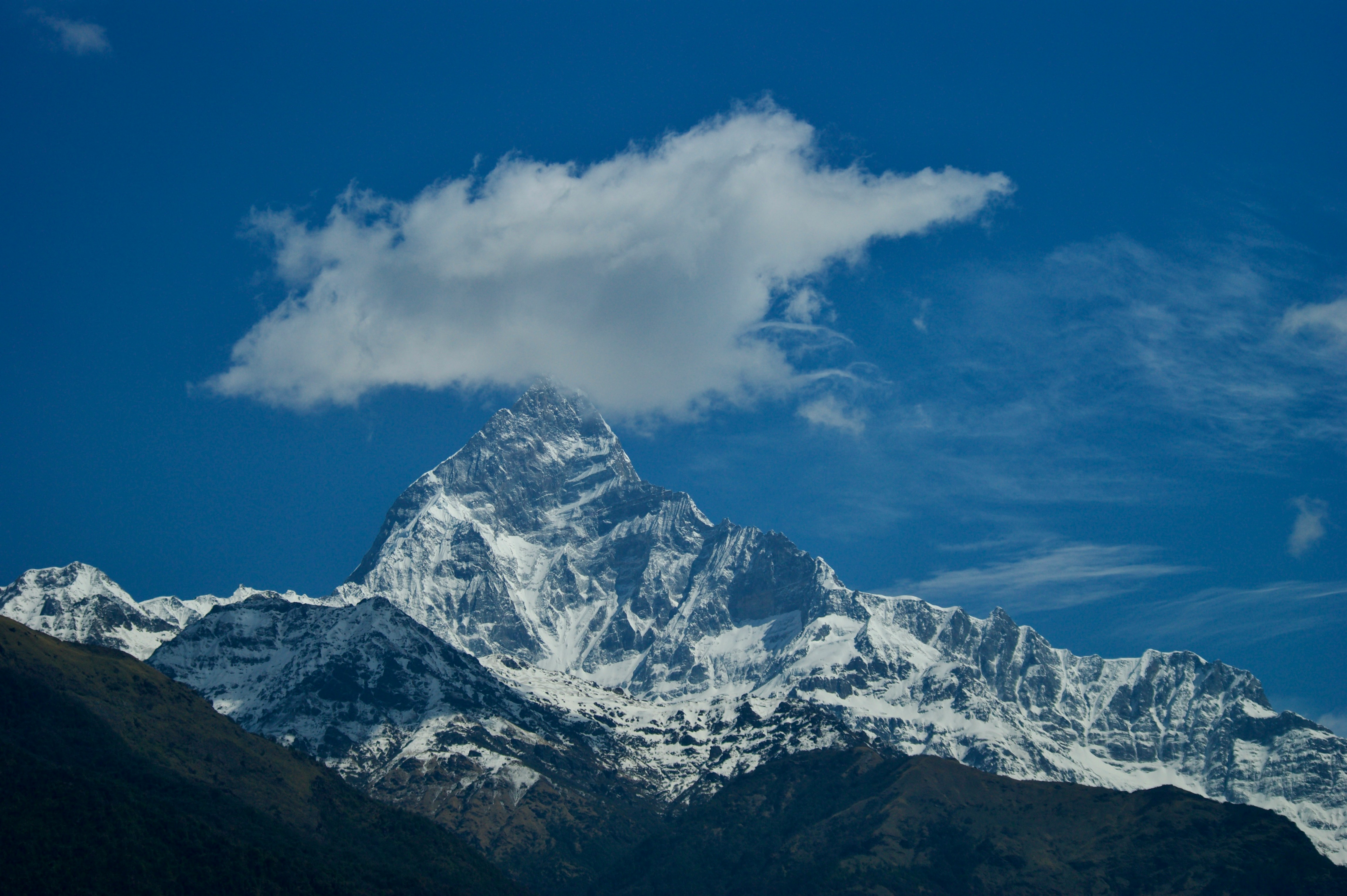
Machapuchare (6,993 m), locally known as Machhapuchhre, is a sacred mountain in Nepal’s Annapurna Himal range. Its name means “Fish Tail” in Nepali, reflecting the twin summit ridges that resemble a fish’s tail when viewed from a distance. Revered as the home of Lord Shiva, it has never been officially climbed. In 1957, a British team reached within 50 meters of the summit but turned back to honor local beliefs and a promise to King Mahendra.\n\nSince then, Nepal has banned climbing permits, keeping the mountain untouched. Although there are unverified claims of an illegal ascent in the 1980s, Machapuchare remains officially unclimbed.
MT. Num Ri | 2nd

MT. Num Ri | 2nd

6,959 m | Nepal

Num Ri (6,959 m) is a striking mountain in Nepal’s Khumbu region, part of the Mahalangur Himal. The name comes from Tibetan, where “Num” means sky or radiance and “Ri” means mountain, giving it the meaning “Sky Mountain” or “Radiant Mountain.” The peak forms a long crest ending in a pyramid-shaped summit capped by hanging glaciers, and it stands near Island Peak, Cho Polu, and Baruntse.\n\nNum Ri was first and only successfully climbed on November 7, 2002, by German climbers Olaf Rieck, Lydia Schubert, and Carsten Schmidt via the northwest ridge. Their ascent required two high camps and nearly 800 meters of fixed rope, with constant dangers from avalanches, falling ice, and collapsing glacier slabs - one of which narrowly missed a climber at around 5,900 m. Despite the risks, the team safely reached the summit, making Num Ri one of the lesser-known but formidable peaks of the Khumbu Himal.
MT. Kanjiroba | 3rd

MT. Kanjiroba | 3rd

6,883 m | Nepal

Kanjiroba (6,883 m), locally known as काञ्जिरोबा (Kanjiroba), is a major peak in the Kanjiroba Himal of Nepal’s Dolpa District, Karnali Province. The name comes from the local Tibetan and Nepali languages: “Kanji” refers to the area or valley where the mountain is located, and “Roba” means mountain, so the name roughly translates to “Mountain of the Kanji area.” Rising to 6,883 meters with a prominence of 1,870 meters, it is one of the highest mountains in the region.\n\nThe first successful ascent was made in 1970 by the Osaka City University Himalayan Expedition, which also explored the surrounding Patrasi Himal for the first time. Since then, Kanjiroba has been summited, though it remains less frequently climbed due to its remote location and challenging access.
MT. Ama Dablam | 4rth

MT. Ama Dablam | 4rth

6,812 m | Nepal

Ama Dablam (6,812 m) is a striking peak in Nepal’s Khumbu region, located within Sagarmatha National Park, a UNESCO World Heritage Site. Its name comes from the Sherpa language: “Ama” means mother, and “Dablam” refers to a traditional double-pendant containing pictures of the gods worn by Sherpa women. The mountain’s long ridges are seen as the arms of a mother protecting her child, while the hanging glacier represents the dablam, symbolizing a mother’s necklace. Ama Dablam was first successfully climbed on March 13, 1961, by Mike Gill (New Zealand), Barry Bishop (USA), Mike Ward (UK), and Wally Romanes (New Zealand) via the Southwest Ridge, which remains the most popular route. Known for its technical difficulty, the mountain requires advanced rock, snow, and ice climbing skills.\n\nAs of early 2025, over 6,000 successful summits have been recorded, with a summit success rate ranging between 60% and 75%, depending on weather and season.
MT. Cho Polu | 5th

MT. Cho Polu | 5th

6,735 m | Nepal

Cho Polu (6,735 m ) is a prominent mountain located in the Mahalangur Range of eastern Nepal, situated between the popular trekking peak Imja Tse (Island Peak) and the more challenging Baruntse. The name Cho Polu is derived from the local Sherpa language, where "Cho" means "lake" and "Polu" means "peak", collectively translating to "Lake Peak". This name reflects the mountain's proximity to the glacial lakes in the region, particularly the Imja Tsho lake located to the west.\n\nThis mountain is a remote and technically challenging peak in eastern Nepal. The first known ascent was a solo climb by Spanish climber Nil Bohigas Martorell on November 1, 1984, via the north face and northeast ridge, done without official permits. Earlier claims from 1954 (Norman Hardie) and 1964 (Japanese expedition) are disputed. The first official ascent was completed by a German team - Olaf Rieck, Dieter Rülker, Markus Walter, and Günter Jung - on November 12, 1999. Due to its difficult terrain and remote location, Cho Polu has had only a few recorded ascents.
MT. Khumbutse | 6th

MT. Khumbutse | 6th

6,636 m | Nepal

Khumbutse (6,636 m) is a prominent mountain located on the border between Nepal and China (Tibet). Its name derives from the Khumbu region in Nepal, indicating its position at the head of the Khumbu Valley, down which the Khumbu Glacier flows. The name "Khumbutse" reflects its geographical location and significance in the region.\n\nThe first known ascent of Khumbutse was made in 1979 by Slovenian climber Franček Knez, who reportedly soloed the peak via its north face. This ascent is considered the first confirmed summit of the mountain. While there were earlier claims of ascents in 1954 by Norman Hardie and in 1964 by a Japanese expedition, these claims are disputed and not widely accepted in the climbing community.\n\nKhumbutse remains a relatively less-climbed peak, with only a few recorded ascents. Its challenging terrain and technical routes contribute to its low summit frequency. The mountain's remote location and the necessity for advanced mountaineering skills further limit the number of expeditions attempting to reach its summit.
MT. Thamserku | 7th

MT. Thamserku | 7th

6,623 m | Nepal

Thamserku (6,623 m), located in Nepal’s Khumbu region east of Namche Bazaar, is a prominent snow-covered peak. Thamserku, is believed to mean “The Saddle of the Snow God” in the Sherpa language. The mountain was given this name because of its graceful, saddle-shaped summit and sweeping ridgelines, which resemble a majestic saddle in the sky. The first ascent was made on November 4, 1964 by Lynn Crawford, Peter Farrell, John McKinnon, and Richard Stewart of Edmund Hillary’s Schoolhouse Expedition via the south ridge.\n\nIn 2014, Russian climbers Alexander Gukov and Alexey Lonchinskiy completed the first ascent of the technically challenging southwest face. Thamserku remains relatively less climbed due to its remote location and difficult, technical routes.
MT. Chulu East | 8th

MT. Chulu East | 8th

6,584 m | Nepal

Chulu East (6,584 m) is a prominent peak in Nepal’s Annapurna region, part of the Damodar Himal range in Gandaki Province within the Annapurna Conservation Area. Its name Chulu means “thumb” in the local language, likely referring to the mountain’s distinctive shape. The first confirmed ascent was made in 1955 by a German expedition via the northeast ridge, which remains the standard climbing route.\n\nThe ascent involves glacier crossings, steep scree slopes, and sections requiring fixed ropes, making it a moderately technical climb. The summit success rate is approximately 70-80%, depending on weather, acclimatization, and climbers’ experience, with climbers rewarded by panoramic views of Annapurna II, III, IV, and Gangapurna.
MT. Taboche | 9th

MT. Taboche | 9th

6,495 m | Nepal

Taboche (6,495 m), also known as Tawoche, is a prominent peak in Nepal’s Khumbu region, located near the villages of Pheriche and Dingboche. It is connected to Cholatse by a long ridge and lies across the Imja River from Ama Dablam. The first confirmed ascent was made on April 15, 1974, by a French expedition led by Yannick Seigneur, with team members Louis Dubost, Paul Gendre, and Jacques Brugirard.\n\nNotable subsequent ascents include the winter climb of the northeast face by Jeff Lowe and John Roskelley in 1989, and the first ascent of the north face by Japanese climbers Fumitaka Ichimura and Genki Narumi in 2009. Climbing Taboche requires technical skills, glacier travel, and steep slope navigation. The summit success rate is around 70-80%, depending on weather, acclimatization, and climbers’ experience, offering panoramic views of the surrounding peaks including Ama Dablam.
MT. Mera Peak | 10th

MT. Mera Peak | 10th

6,476 m | Nepal

Mera Peak (6,476 m), located in Nepal’s Mahalangur Himal within the Sagarmatha Zone, is the highest trekking peak in the country. Its name Mera comes from the local Sherpa language, meaning “my,” reflecting its significance to the local community. The first confirmed ascent was made on May 20, 1953, by Colonel Jimmy Roberts and Sen Tenzing, a Sherpa who had assisted in the 1952 Everest expedition. Mera North, the highest of its three main summits, was first climbed in 1975 by French climbers Marcel Jolly, G. Baus, and L. Honills.\n\nThe standard route involves glacier travel with sections requiring fixed ropes. Mera Peak is popular among trekkers and climbers, offering panoramic views of five of the world’s highest mountains: Everest, Lhotse, Makalu, Cho Oyu, and Kangchenjunga. The summit success rate is approximately 70-80%, depending on weather, acclimatization, and climbers’ experience.
MT. Hiunchuli | 11th

MT. Hiunchuli | 11th

6,441 m | Nepal

Hiunchuli (6,441 m), locally known as Hiun Chuli, is a prominent peak in Nepal’s Annapurna region near the entrance to the Annapurna Sanctuary. In the local Sherpa/Tamang language, Hiun refers to “snow” or “ice,” and Chuli means “peak” or “summit,” so the name roughly translates to “Snow Peak.” The first confirmed ascent was in October 1971 by Craig Anderson and his team via the southeast face.\n\nThe climb is challenging due to steep terrain, rockfalls, and avalanches, and the mountain is less frequently climbed because of its remote location and technical routes. The summit success rate is around 25%, reflecting the difficulty of the peak.
MT. Cholatse | 12th

MT. Cholatse | 12th

6,440 m | Nepal

Cholatse (6,440 m), locally known as Jobo Lhaptshan, is a prominent peak in Nepal’s Khumbu region, located between the Gokyo and Khumbu valleys. Its name comes from Tibetan words: cho (lake), la (pass), and tse (peak), meaning “Lake Pass Peak.”\n\nThe first confirmed ascent was on April 22, 1982, by an American team via the southwest ridge, while the north face was first climbed in 1996 by a French team. Cholatse is highly technical, involving steep rock and ice sections, and is considered a challenging alpine-style climb. Its summit success rate is relatively low due to the technical difficulty and demanding conditions.Its unique combination of aesthetics and technical difficulty sets it apart, and its summit success rate is relatively low due to these demanding conditions.
MT. Langshisa Ri | 13th

MT. Langshisa Ri | 13th

6,427 m | Nepal

Langshisa Ri (6,427 m), also called Langshisha Ri, is a prominent peak in Nepal’s Jugal Himal range within Langtang National Park. Its name comes from Tibetan: “Lang” meaning “following” and “Shisa” meaning “yak,” translating to “Following Yaks Peak.” The first confirmed ascent was made on April 23, 1982, by Japanese climber Takuya Kajimoto and Sherpa Pasang Norbu. Originally considered a full expedition peak, it was later reclassified as a trekking peak by the Nepal Mountaineering Association in 2002, making it more accessible.\n\nThe climb is technically challenging, involving steep rock and ice sections, requiring advanced mountaineering skills. Langshisa Ri is unique for its panoramic views of surrounding giants such as Langtang Lirung, Ganchenpo, and Dorje Lakpa, offering both aesthetic beauty and a demanding climbing experience. The summit success rate is relatively low due to its technical difficulty and challenging terrain.
MT. Kusum Kangguru | 14th

MT. Kusum Kangguru | 14th

6,367 m | Nepal

Kusum Kangguru (6,367 m ), also known as Kusum Kangru, is a prominent peak in Nepal’s Khumbu region. Its name means “Three Snow Peaks” in the local Sherpa language, referring to its distinctive triple summit. The mountain is highly technical, featuring steep rock and ice faces, multiple ridges, and a dramatic north face, making it one of the most challenging climbs in the region. The first ascent was achieved by New Zealand climber Bill Denz on October 7, 1981, via the southwest buttress, which also marked the first solo ascent and traverse. The second ascent, by a Japanese team, followed the southeast face five days later.\n\nDue to its technical difficulty and remote location, Kusum Kangguru has a low summit success rate of approximately 25-30%, attracting only experienced mountaineers seeking a demanding and rewarding climb.
MT. Island Peak | 15th

MT. Island Peak | 15th

6,189 m | Nepal

Island Peak (6,189 m), locally known as Imja Tse, is a popular trekking peak located in Nepal’s Khumbu region near the village of Chhukung. The name Imja Tse refers to its location above the Imja Glacier, while the nickname “Island Peak” was given by British climbers in 1953 because the peak rises like an island from the surrounding glaciers. The first ascent was made on May 6, 1953, by a British expedition including Tenzing Norgay, who later became famous for summiting Everest. Island Peak is considered a moderate climb suitable for trekkers with basic mountaineering experience, involving glacier travel, ice climbing, and the use of fixed ropes near the summit.\n\nIts popularity and relatively straightforward routes result in a high summit success rate, typically around 70-80%, making it one of the most accessible peaks in the Himalayas for adventure climbers.
MT. 16.	Kongde Ri | 16th

MT. 16. Kongde Ri | 16th

6,187 m | Nepal

Kongde Ri (6,187 m), also known as Kwangde Ri or Kwande, is a prominent peak in Nepal’s Khumbu region, located about 4 km west of Namche Bazaar. The name Kongde means “Holy Peak” in the Sherpa language, reflecting its spiritual significance to the local community. The first successful ascent was on October 17, 1975, by a Nepalese team led by Lhakpa Tenzing, Sonam Gyalzen, Shambhu Tamang, and Sonam Hisi via the south ridge. An earlier ascent of the East Peak was completed in 1973 by a German team. Kongde Ri is a multi-summit peak with steep rock and snow faces, making it technically challenging despite being classified as a trekking peak.\n\nIts unique combination of dramatic terrain, panoramic views of Everest, Lhotse, Makalu, and Cho Oyu, and remote location makes it highly respected among climbers. The summit success rate is relatively low, around 20-30%, due to its technical difficulty and challenging conditions.
MT. 17.	Lobuche East | 17th

MT. 17. Lobuche East | 17th

6,119 m | Nepal

Lobuche East (6,119 m) is a well-known trekking peak in Nepal’s Khumbu region, situated near the village of Lobuche on the Everest Base Camp trail. Its name is derived from the nearby village, though the exact meaning in Sherpa is not clearly known. The peak was first successfully climbed on April 25, 1984, by Laurence Nielson along with Sherpa Ang Gyalzen via the East Ridge. Recognized as a trekking peak by the Nepal Mountaineering Association, Lobuche East features technical sections of snow and ice that require the use of crampons, ice axes, and fixed ropes.\n\nThe summit offers breathtaking panoramic views of Everest, Lhotse, Nuptse, and Pumori. With proper acclimatization and preparation, climbers achieve the summit in 70-90% of attempts, making it a popular choice for those seeking a challenging yet accessible Himalayan climb.
Mt. Nirekha Peak | 18th

Mt. Nirekha Peak | 18th

6,069 m | Nepal

Nirekha Peak (6,069 m) is a notable trekking peak in Nepal’s Khumbu region, situated near the Gokyo Valley and Cho La Pass. Its local name, Nirekha, is linked to the peak’s distinctive ridge formation, though the exact translation is unclear. The first successful ascent was made in the early 1980s via the south or southeast ridges. Classified as a moderate-to-technical trekking peak, Nirekha involves climbing snow and ice slopes, requiring crampons, ice axes, and basic rope techniques. From the summit, climbers can enjoy sweeping views of nearby giants such as Cho Oyu, Everest, and Ama Dablam.\n\nThe peak has a summit success rate of about 60-75%, making it a popular choice for trekkers aiming to experience high-altitude Himalayan climbing with manageable technical challenges.
MT. Kwangde Peak | 19th

MT. Kwangde Peak | 19th

6,011 m | Nepal

Kwangde Peak (6,011 m) is a trekking peak in Nepal’s Khumbu region, near Namche Bazaar. Its local Sherpa name, Kwangde, carries cultural significance, though its exact meaning is not clearly documented. The first successful ascent took place in the 1980s. Classified as a moderate-to-technical trekking peak, Kwangde features snow and ice slopes, ridges, and some exposed sections, requiring the use of crampons, ice axes, and basic rope skills.\n\nThe summit provides stunning panoramic views of major Himalayan peaks such as Everest, Lhotse, and Ama Dablam. With a summit success rate of around 60-70%, it is a popular choice for trekkers looking to experience high-altitude climbing in the Himalayas without extreme technical challenges.
MT. Pisang Peak | 20th

MT. Pisang Peak | 20th

6,091 m | Nepal

Pisang Peak (6,091 m) is a trekking peak in Nepal’s Manang region, situated along the Annapurna Circuit. Its local name, Pisang, comes from the nearby village, though the exact meaning is not clearly documented. The first recorded ascent was in the mid-20th century. Pisang Peak is considered a moderate trekking peak, featuring snow and ice slopes with some exposed sections that require crampons, ice axes, and basic rope techniques.\n\nThe summit provides beautiful views of the Annapurna range, including Annapurna II, Gangapurna, and Pisang Peak’s neighboring peaks. Its summit success rate is relatively high, around 70-85%, making it a popular peak for trekkers and climbers seeking their first high-altitude Himalayan experience.
MT. Ramdung Go Peak | 21st

MT. Ramdung Go Peak | 21st

5,925 m | Nepal

Ramdung Go Peak (5,925 m) is a trekking peak situated in Nepal’s Khumbu region near Dingboche village. The name Ramdung Go comes from the local Sherpa language, though its precise meaning is not well-documented. The first successful ascent occurred in the late 20th century. As a moderate trekking peak, it features snow and ice slopes that require basic mountaineering skills, including the use of crampons, ice axes, and ropes.\n\nFrom the summit, climbers are rewarded with spectacular views of surrounding Himalayan giants such as Ama Dablam, Lhotse, and Island Peak. With a relatively high summit success rate of 65-75%, Ramdung Go is a popular option for trekkers seeking their first high-altitude Himalayan climb.
MT. Pokalde | 22nd

MT. Pokalde | 22nd

5,806 m ( Nepal ) |

MT. Yala Peak | 23rd

MT. Yala Peak | 23rd

5,520 m | Nepal

Yala Peak (5,520 m) is a trekking peak located in Nepal’s Langtang region, near the village of Yala. Its local name, Yala, comes from the nearby area, though the exact meaning in the Sherpa language is not clearly documented. The peak was first climbed in the late 20th century. The summit provides best views of Langtang Lirung, Ganesh Himal and surrounding peaks.\n\nYala Peak in Nepal’s Langtang region is a popular trekking peak suitable for climbers with basic mountaineering skills. The climb involves snow and moderate ice slopes, using crampons and ice axes. Since the first ascent in the late 20th century, around 1,200-1,500 climbers have reached the summit. The peak has a high success rate of 75-85%, making it an accessible and frequently climbed Himalayan peak.