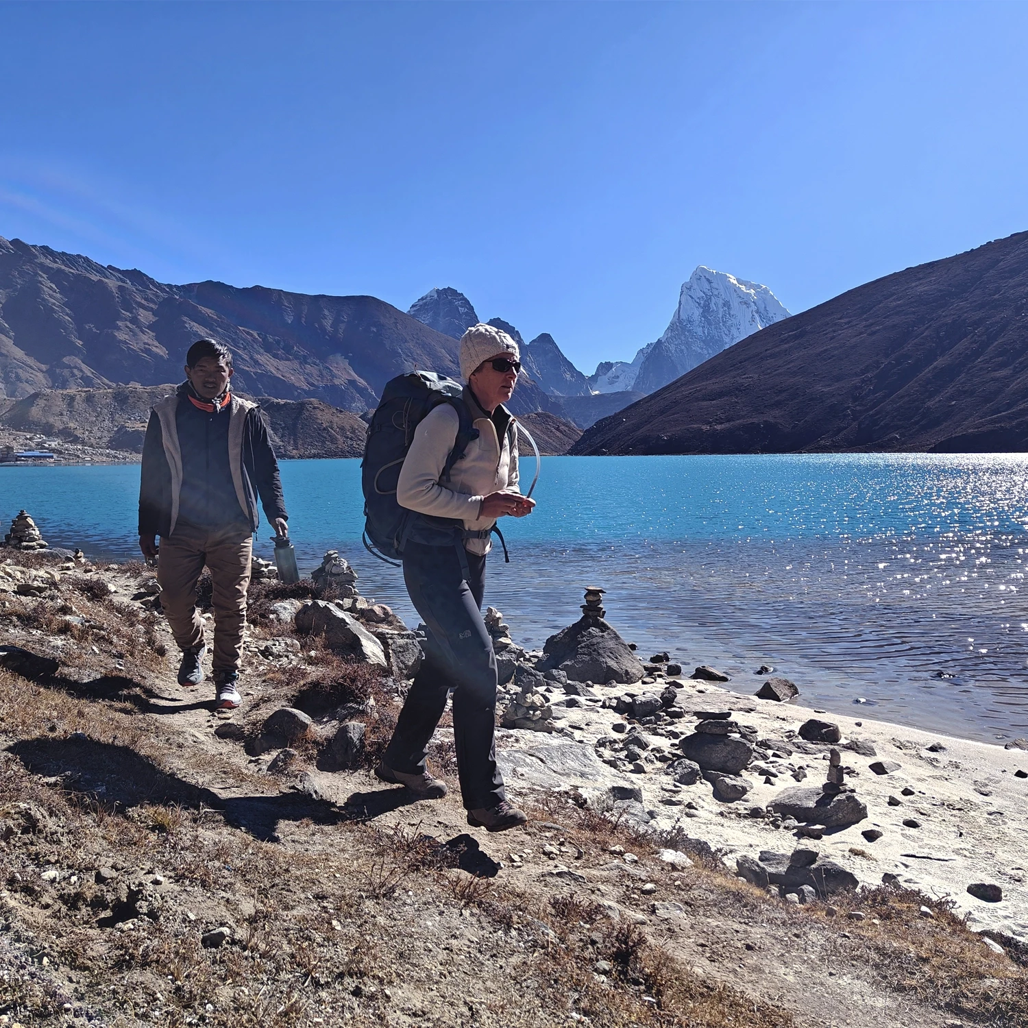
The Everest High Route Trek is one of Nepal’s most spectacular and rewarding trekking circuits, leading deep into the heart of the Everest region. The journey offers high-altitude landscapes, vast glaciers and iconic Himalayan mountains. Mount Everest (8,848.86 m), the world’s highest peak, is known as Sagarmatha in Nepali and Chomolungma in Sherpa (Tibetan). The mountain is considered sacred and the local Sherpa people worship it as a god. The adventure begins with a scenic flight from Kathmandu to Lukla, situated to the north-east of the capital, a bustling Sherpa town and the main gateway to the region. From Lukla, the trail follows the north-flowing Dudh Koshi River, crosses the famous Hillary suspension bridges, and passes through traditional Sherpa villages before reaching Namche Bazaar, the vibrant Sherpa capital. The global trail is relatively easy, but the high altitude makes it challenging. An excursion at Namche for acclimatization can be perfect.
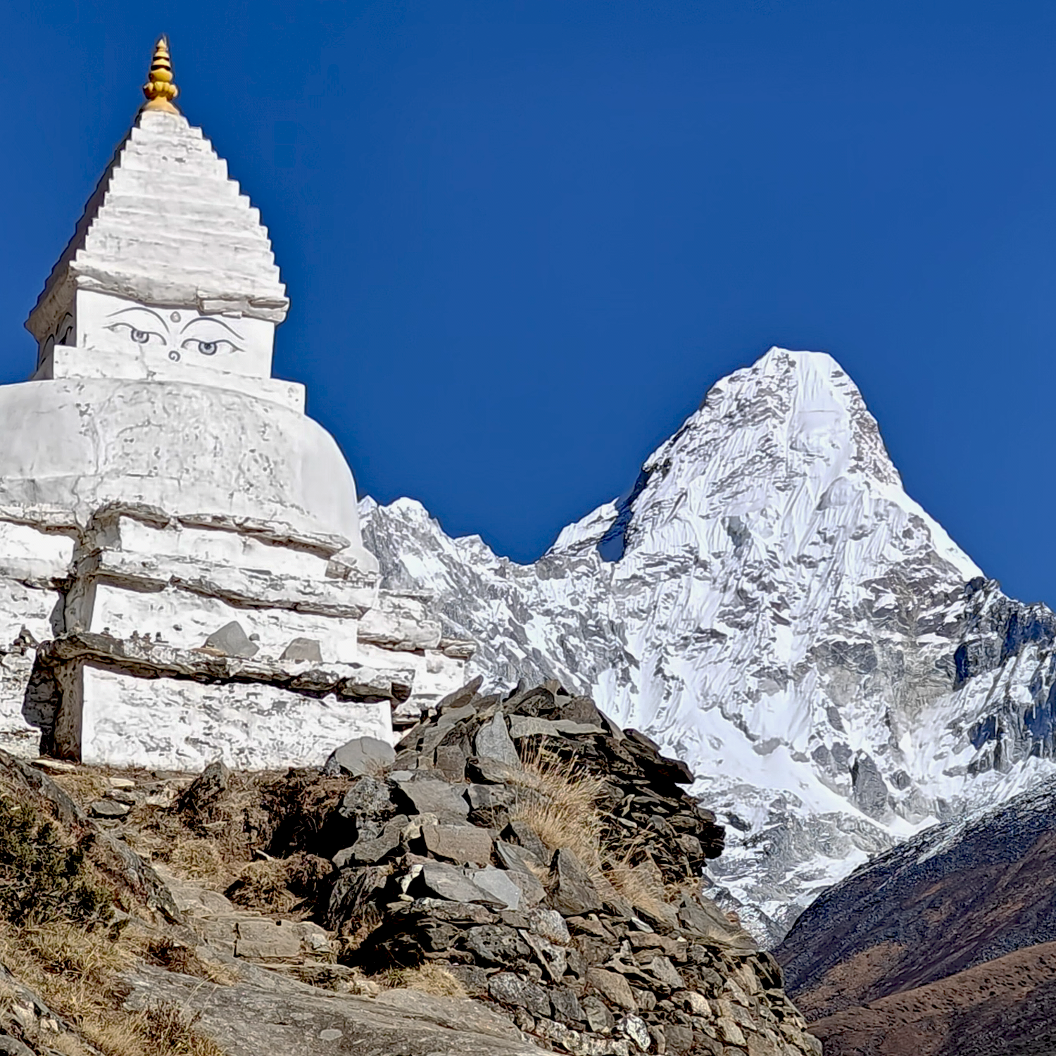
The trek crosses three legendary and challenging high passes: Renjo La (5,360 m), Cho La (5,420 m), and Kongma La (5,535 m). Highlights include Everest Base Camp and Kala Patthar (5,545 m). The ascent of Kala Patthar offers unforgettable close-up views of Everest. The route passes the serene Gokyo Valley, sacred Gokyo Lakes, the vast Ngozumpa Glacier, the longest glacier in the world and the Khumbu Glacier. Ascents to Gokyo Ri and Chhukung Ri provide sweeping views of Everest, Lhotse, Makalu, Cho Oyu and surrounding mountains. The trek also showcases Sherpa culture, with ancient monasteries such as Thame (Upper Pangboche) and the iconic Tengboche Monastery, as well as mani stones and chortens along the trail.
The return journey passes Pheriche, Pangboche and Tengboche, reaching Lukla, where the adventure concludes with a sense of accomplishment and awe. This trek leaves lasting memories of towering peaks, rich Sherpa culture, and the extraordinary landscapes of the Everest region.
Arrive Kathmandu (1350m). Transfer to the hotel
Your memorable holiday begins in Kathmandu. After arrival, you will have time to freshen up before meeting your guide for an afternoon briefing. This is the perfect moment to organize your trekking gear and prepare your bags for the journey ahead.
Accommodation: Hotel. Meals included: morning
Transport : 20 M drive hotel.
Kathmandu - Ramechhap - Lukla (2860 m) - Phakding (2610 m)
Early in the morning, we drive to Ramechhap (Manthali Airport), which takes about 4 to 5 hours depending on traffic and road conditions. From Ramechhap, you'll board a short 20 minute flight to Lukla, the main gateway to the Everest region. Upon arrival in Lukla, the trek starts with a gradual descent through alpine forests, suspension bridges, and charming Sherpa villages. After 3 to 4 hour walk, you’ll reach Phakding, a scenic riverside village and the first overnight stop on the trail toward Everest Base Camp.
Note:
Due to potential congestion at Kathmandu Airport, the Civil Aviation Authority of Nepal (CAAN) may mandate that all flights to Lukla operate either from Kathmandu Airport or from Ramechhap Airport.
In the event that the flight is canceled due to adverse weather conditions, it will be rescheduled for the following day. An additional night’s accommodation will be provided either in Kathmandu or Ramechhap, depending on the point of departure.
Accommodation: lodge. Meals included: morning noon evening.
Transport : 4/5 hours drive by jeep ( Ramechhap), 25 minutes flight (Lukla).
Elevation gain: 200 m . Elevation loss : 450 m . 3/4 hours walking.
Phakding - Namche Bazaar (3440 m)
Today, we starts with a pleasant walk through a pine forest along the river, followed by a short climb out of a narrow gorge. After passing the entrance to Sagarmatha National Park, where permits are checked, we descend to cross the river on a suspension bridge. The trail continues through a wooded valley, crossing the river again before reaching a confluence from Thame and the Khumbu. A final crossing on a high suspension bridge marks the start of a challenging 1.5 hours ascent to Namche Bazaar, with our first views of Everest midway.
Upon arrival, we check into a local lodge. Once a quiet village, Namche has evolved into a bustling trekking hub, offering a mix of tradition and modernity - complete with bakeries, cafés, pubs, and other comforts brought back by well-traveled Sherpas.
Accommodation: lodge. Meals included: morning noon evening.
Elevation gain: 1178 m . Elevation loss : 409 m . 6/7 hours walking.
Day Excursion, Everest View Point -Khumjung (3790m)
Finally, well-deserved rest day to acclimatize and enjoy the surroundings. For those inclined, a hike to the Everest View Hotel (3,880 m) offers awesome scenic views of the Himalayas. Alternatively, you may choose to explore Namche Bazaar - relax in a local café, browse the lively market for unique items, or visit the Sherpa Museum to gain insight into local culture. The day concludes with an overnight stay in this iconic mountain village.
Accommodation: lodge. Meals included: morning noon evening.
Namche Bazaar - Thame (3820m)
As we leave the main Everest trail behind, the peacefulness of this less-travelled valley becomes immediately apparent, offering a welcome contrast to the busier paths from Lukla. After approximately three to four hours of walking, we reach a dramatic suspension bridge stretched high above the river. From here, the trail ascends steadily to the village of Thame, strategically located at the historic junction of trading routes from Rolwaling via the Tasi Labcha Pass and from Tibet via the Nangpa La.
Accommodation: lodge. Meals included: morning noon evening
Elevation gain : 520 M Elevation loss: 235 m. 5/6 hours walking.
Thame - Lungden (4,380m)
After breakfast, we trek towards Morulung and Lungden, entering the valley mostly known as the Nangpa La Valley. This old trade route is linked to many local legends and was used by Tibetan traders and monks. Today’s walk is not difficult, but the altitude is strongly felt. The landscape is open, dry, and almost without vegetation. We continue to Lungden, a small Sherpa village and the starting point for the route to Nangpa La Pass on the Tibetan border.
Accommodation: lodge. Meals included: morning noon evening
Elevation gain : 640 m Elevation loss: 0 m. 4/5 hours walking.
Lungden - Renjola Pass (5360 m) - Gokyo Lake (4800m)
Early in the morning, we begin this long yet magnificent day with confidence and calm. The ascent to the pass is challenging, but it leads to the best viewpoint. From the top, a spectacular panorama unfolds: a chain of the world’s highest peaks, including Everest, Makalu and Pumori, stretches to the east, while the turquoise waters of Lake Gokyo lie far below. Nearby rises the imposing south face of Cho Oyu. We then descend towards the Gokyo Glacier, cross it carefully, and continue to the peaceful shores of Lake Gokyo.
Accommodation: lodge. Meals included: morning noon evening
Elevation gain : 1100 m Elevation loss: 600 m. 7/8 hours walking.
Gokyo - Gokyo Peak (5357 m) - Thangnak (4,700m)
Today we climb Gokyo Peak (5,357?m). The views are almost as stunning as from Renjo La Pass. The climb takes around 2 hours. It is steep but very rewarding. From the top, you can see Everest, Lhotse, and the beautiful Gokyo Lakes. After photos, we hike back to Gokyo for lunch. Then we continue to Thangnak, a trek of around 2 hours, crossing the Ngozumba Glacier, the world’s longest glacier. Walking on the glacier is not easy, so careful attention is required.
Note: For those who prefer, it is optional to rest in Gokyo instead of climbing Gokyo Peak
Accommodation: lodge. Meals included: morning noon evening
Elevation gain: 790 m or 210 m. Elevation loss: 900 m or 300 m.
2 hours 15 minutes (without Gokyo Peak) walking, 5 hours 30 minutes (including).
Thangnak - Cho La Pass (5420m) - Dzongla (4,830m)
In the early morning, we set off for another challenging day, crossing the Cho La Pass. As we approach, we navigate a wide boulder field, left by an ancient moraine. Some sections are steep and may require light scrambling. From the top, we are rewarded with spectacular views, including Ama Dablam from the northwest. We then descend to the grazing pastures below, where the trail becomes easier. Finally, we reach our overnight stop at Dzongla.
Accommodation: lodge. Meals included: morning noon evening
Elevation gain : 300 m Elevation loss: 200 m. 2/4 hours walking.
Dzongla - Goraksheep (5,164M)
We start from Dzongla, bottom of Dzongla Peak. The surrounding mountains are magnificent. The trail passes above Chola Tso, a green and beautiful lake. The path is easy and scenic. Before joining the Everest Hillary Trail, another panoramic view opens up, including Everest Base Camp, Lhotse, Nuptse, Pumori, Khumbutse, Ama Dablam, Lobuche Peak, and the Everest climbers’ memorial spot. After Lobuche, the trail approaches the Khumbu Glacier, with some sections going up and down. The day ends at Gorakshep, the final stop before Everest Base Camp and an important point for both trekkers and climbers.
Accommodation: lodge. Meals included: morning noon evening
Elevation gain: 825 m . Elevation loss :545 m . 6/7 hours walking.
Goraksheep - Everest Base Camp (5364 m) - Goraksheep
In the morning, we set out from Gorak Shep for an excursion to Everest Base Camp, crossing the Khumbu Glacier for about 3 km. Although the walk is relatively short, it is incredibly rewarding, fueled by the excitement of reaching the base camp amidst the rugged mountain landscape. After exploring the camp, we return to Gorak Shep for lunch and a well-deserved rest.
Accommodation: lodge. Meals included: morning noon evening
Elevation gain: 150 m. Elevation loss : 150 m. 3/4 hours walking.
Goraksheep - Kala Patthar (5545 m) - Lobuche
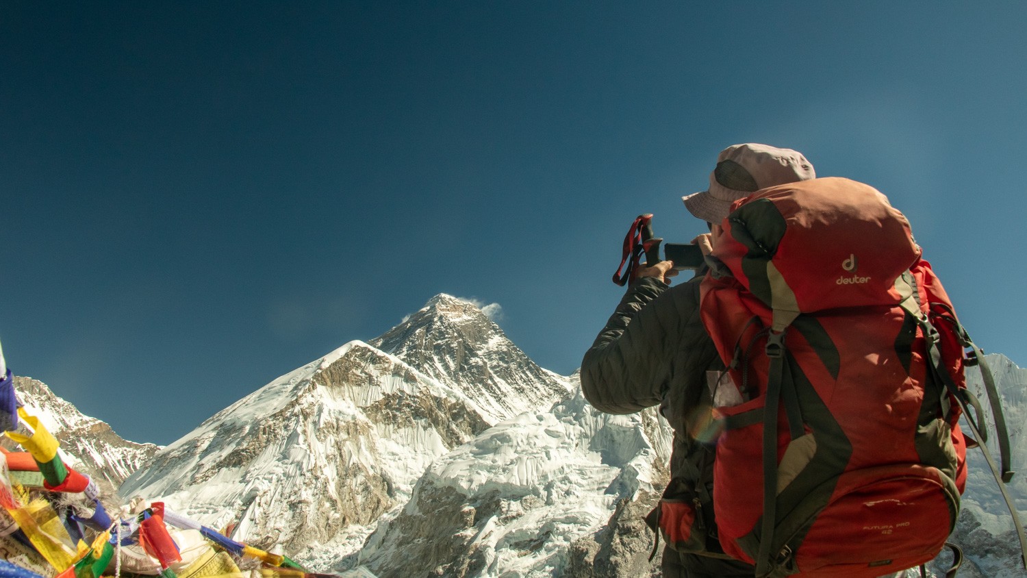
In the morning, we walk from Gorak Shep to Kala Patthar, one of the best viewpoints in the region and the closest place to see Mount Everest. From the top, we enjoy clear views of Everest, Nuptse, Pumori and the surrounding Himalayan peaks. After spending some time at the summit, we descend back to Gorak Shep and then continue on to Lobuche, following the familiar trail across the rocky moraine.
Note:- It is not necessary to start the climb early in the morning, as the sun rises in the east and Kala Patthar lies directly behind it. The light at sunrise is therefore not ideal for photographs.
Accommodation: lodge. Meals included: morning noon evening
Elevation gain: 450 m. Elevation loss : 690 m. 5 hours walking.
Lobuche - Kongma la (5,535m)- Chhukung (4,730m)
We cross the Khumbu Glacier to reach Kongma La Pass. The climb to the pass is steady and demanding. From the top, there are clear views of the glacier and the Everest Valley, with Nuptse rising above. Nearby stands Imja Tse (Island Peak), a popular trekking peak that is also well known as the approach route to the challenging Amphu Lapcha Pass. We then make a long descent to Chukhung, set below the famous south face of Lhotse.
Accommodation: lodge. Meals included: morning noon evening
Elevation gain: 670 m. Elevation loss : 1250 m. 6/7 hours walking.
Chhukung - Chhukung Ri (5,550 m)- Chhukung
Early in the morning, we set out to climb Chukhung Ri. This is a non-technical ascent with wide views of the surrounding peaks, including Lhotse, Makalu, Baruntse and the striking Ama Dablam. Thamserku and Cholatse can be seen to the west. The climb is similar in effort and reward to Kala Patthar, making Chukhung Ri one of the finest viewpoints in the region.
Note: Taking this optional rest makes the descent more comfortable.
Accommodation: Lodge. Meals included: morning afternoon evening.
Elevation gain : 900 m Elevation loss: 900 m. 4/5 hours walking.
Chhukung - Tengboche (3,867m)
Today, we enjoy a gentle descent into the Khumbu Valley, walking beneath the impressive slopes of Ama Dablam. We pass through the permanent village of Dingboche, where farming remains part of everyday life, and gradually enter a tree-lined landscape. We stop at Pangboche for a short visit to Upper Pangboche. After crossing the bridge, we follow a shaded trail with a short climb to reach Tengboche, the largest monastery in the region, and it has long been the centre of Sherpa religious life and ceremonial gatherings.
Accommodation: Lodge. Meals included: morning afternoon evening.
Elevation gain :100 m. Elevation loss: 1000 m. 6/7 hours walking.
Tengboche - Namche Bazaar
From Tengboche, we descend through rhododendron and pine woodland. We often hear the sounds of prayer wheels and birds. The path drops steeply to the Dudh Koshi River. We cross it on a suspension bridge. We then follow a steady, well-marked trail, climbing gradually through the trees. As we approach Namche Bazaar, Everest and the surrounding peaks come into view. The trail levels out as we reach the lively Sherpa town of Namche.
Accommodation: Lodge. Meals included: morning afternoon evening.
Elevation gain : 420 m Elevation loss: 420. 5/6 hours walking.
Namche -Lukla
Today, the trek from Namche to Lukla retraces the same scenic route taken on the ascent. we share our final moments with the porters - a meaningful time to reflect on the journey and celebrate the experiences we’ve shared together.
Accommodation: lodge. Meals included: morning noon evening
Elevation gain: 600 m. Elevation loss : 1180 m. 6/7 hours walking.
flight from Lukla -Ramechap and drive to Kathmandu
Start the day with an morning flight from Lukla to Ramechhap, offering final views of the Himalayas. From there, enjoy a scenic drive back to Kathmandu. The rest of the day is free to relax, explore and shop.
Accommodation: Hotel. Meals included: morning afternoon.
Transport : 30 minutes morning flight (Ramechhap), 4/5 hours drive by jeep (Kathmandu)
Kathmandu - Souvenirs day | Sightseeing Day.
If you choose sightseeing, this full-day cultural tour offers a well-rounded experience of Kathmandu’s history, spirituality, and art, guided by a certified expert who will enrich your understanding of the city’s unique heritage.
Suggested itinerary (maximum three sites per day):
- SwayambunathThe price includes a certified cultural guide, a reserved vehicle, and a professional driver for the day.
Pricing per person:
2 - 3 People: €70Final Departure / Back to Native Land
According to your flight schedule, we will drive you to the airport for your onward journey.
Other journeys you may also like, hand-picked to match this trip.